Essays on Circular Cities
In examining how circular cities and settlements were built, and the reasons behind this mode of ancient urban design, one must above all acknowledge the role of the worldview held by sedentary peoples and the conception they had of the celestial spheres and extraterrestrial geometry as spiritual and sacred phenomena. The reality is that a human being who day and night witnessed the movement of stars and luminous planets across the firmament overhead — and perceived from them only mysterious, radiant surfaces rather than spherical volumes — naturally assigned to the circle a value far loftier than that of other shapes found in nature. For thousands of years, humankind has observed the slender crescent of the moon in the dark night sky at the beginning of a thirty-day cycle, and then watched, night after night, as the crescent grew larger and brighter, until it was finally transformed into a complete, brilliantly luminous disk. When night ended and day began, the same phenomenon occurred with the rising sun: the celestial body first appeared on the horizon as a circle of faint light, then, as it climbed to the zenith of the sky, manifested itself as a circle of intense radiance and greater warmth — a continuous, unceasing phenomenon for which no explanation existed, one that throughout the hours of day and night never left the contemplative mind at peace. Thus, in the infinite sky, both the moon and the sun, beyond their mystery, placed a constant emphasis on a particular natural form, and accordingly the love of circular shapes and the belief in their application across the various domains of earthly life grew ever more among humankind. The reality is that from the very beginning, the circle, in comparison with other geometric forms, was a combination of two phenomena: simplicity and impossibility. Unlike other geometric shapes, it could be drawn easily and, moreover, without the need for any special tools, with great precision — all of which in some way spoke to its resemblance to the most mysterious phenomena of the universe. And perhaps for this very reason there was always an effort among nomadic hunter-gatherers and herders to shape their temporary encampments in circular forms, and later, the construction of circular cities upon settling into sedentary life indicated an attention to this particular geometric form. Although invisible at the scale of human movement and presence on the ground (discernible only from a great height), it was regarded as a mark of nomadic and sedentary humanity's reverence for the sacred circles of the sky — a message, of sorts, in the direction of obedience to the supernatural forces whose manifestations they observed in the form of luminous celestial circles throughout the day and night, and to which they attributed their very existence. ... And perhaps the inhabitants of round cities also believed that the celestial circles were watching from above, aware that human beings had bound themselves to living within vast circles upon the earth and to following the sacred geometry of the heavens. This essay has been written with the aim of presenting a prelude to the historical background and creating an impetus for further study of how ancient
circular cities were formed, and continues the studies in this issue of Memar magazine under the name of Hamadan. Undoubtedly, delving into ancient documents and researching archaeological findings regarding the physical structure of Hegmataneh, and illuminating the hidden, legend-like aspects of the circles surrounding this ancient city, can lead to more comprehensive knowledge in this field. Based on what has been discovered from the remains of ancient cities and texts recovered from them in the Iranian plateau and in areas beyond the current national borders, one can affirm that the construction of circular cities by the inhabitants of this homeland began millennia ago and was a customary practice of settled life. Undoubtedly, the remains of circular cities within the territory of Greater Iran, scattered historical written records, and the mythological and legendary stories related to them all call for extensive field research and study. Apart from Hegmataneh — or as the Greeks called it, "Ecbatana" — which was the capital of the Median Empire and subsequently the summer capital of the Achaemenid kings, other cities with circular plans were built across a wide expanse, sharing similar characteristics while possessing their own unique features. The circular enclosures of these cities, which typically combined urban settlement with military garrison, were formed with an awareness of the structural properties and physical strength of this geometric shape against invader attacks. ... Cities such as Ardashir-Khwarrah or Gur, Firuzabad, Darabgird, and the Takht-e Soleyman complex in Iran; the cities of Baghdad, "Hatra," and "Uruk" in the geographic territory of Iraq; the city of Balkh in present-day Tajikistan; the Parthian city of Nisa in Turkmenistan; Zincirli or Sam'al in Turkey; and Tell Hariri or the city of Mari in Syria — these are among the circular cities of which remnants still survive.
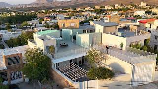
Hamadan — The plan of the city of Hegmataneh, with its circular layout and seven concentric circles arranged as tall encircling ramparts, resembles legendary tales more than anything else, and is considered the most striking example of the application of circular geometry in the body of a great city. Nader Ardalan, in his book The Sense of Unity, in describing concentric and circular cities, has written about Hamadan as the most important circular city: Herodotus's notes on Hegmataneh, the city of the Medes, built in 715 BCE, reveal some of the comprehensive characteristics of this urban form. The city of Hegmataneh was built in a vast location with powerful defensive features and concentric walls. These walls were designed so that the towers and ramparts of each successive circle were taller than those of the circle preceding it. The city's position atop a hill contributed to this feature, although the work had been carried out through deliberate
Aerial photograph of Hamadan in 1976, from the book Lost Paradise by Georg Gerster
and conscious design. The number of circles was seven, and the innermost circle contained the royal palace and the treasury. The circumference of the outer circle was roughly equal to the size of the city of Athens. The battlements and walls of the five outer rings were painted in different colors: the first white, the second black, the third crimson, the fourth blue, and the fifth orange. The walls of the two inner rings were plated with silver and gold respectively. These fortifications were intended to protect the king and his palace, and the people were required to build their houses outside the wall rings. The hierarchy of degrees of purity is shown through the concentric walls and the sequence of their colors. It begins with white, the color of light, followed by a gradual transition toward purity. The golden central wall carries a sign of the sun. According to Herodotus's account, for a people whose God manifests in the complete ring of paradise, the creation of Hegmataneh represents the microcosm manifested within the macrocosm. Hegmataneh, built by order of "Deioces," the first king of the Medes, witnessed the emergence of a royal ritual that had previously appeared in parts of the ancient city of "Sialk." Open audiences and free meetings with the king were forbidden, and being in the king's presence required specific protocols. In government, rule, and in the general worldview, a specific hierarchy was established. Different nations governed one another. The Medes were the rulers at the center and attended only to their nearest neighbors, who in turn governed their neighbors, who dominated the next people, and so on... Unfortunately, despite the extensive excavations and research conducted over several decades and the work of archaeologists at the Hegmataneh mound, no traces have yet been found of the colorful ramparts and walls of the city and the palace of Deioces at its center as described in detail by Herodotus, and to this day the matter has appeared largely as a wistful, unattainable reality. It seems that the circular body of Hegmataneh endured through a long passage of time in the form of Hamadan. Travelers' images of the city and certain historical records have presented it in the form of a city enclosed within a roughly circular fortress. In the modern era, at the beginning of the Pahlavi period, Karl Frisch — an engineer who lacked specialization in urbanism and architecture but was presumably not entirely unaware of Hegmataneh's historical past — by demolishing parts of the bazaar structure and the labyrinthine network of lanes in the city center, designed a vast star-shaped street network and a grand square, with an appearance very different from Iranian architecture and drawing on the Gothic architectural standards of major European cities, right at the physical center of the city. Regardless of the problems or merits of this style of urban design, Hamadan remains, among all the cities of this land, quite distinct in terms of its urban form, access network, and the fabric of surrounding buildings.
Darabgird — Darabgird is a historic city and military garrison in the east of Fars Province, seven kilometers from present-day Darab. Although its antiquity dates back to the mighty Achaemenid dynasty, traces from the fifth and sixth millennia BCE have also been found in its vicinity. After Hegmataneh, this city is considered among the first circular cities of Iran, with an approximate radius of 1,020 meters (a diameter of about 2 kilometers) and an area of 32 square kilometers. Built 2,600 years ago by Darab or Darius II, the city had a conical encircling rampart built of stone and lime mortar, exceeding 10 meters in height, which still stands despite some damage. Behind this enclosing wall, a large moat and water channel with an average width of 30 meters and a depth of 4 to 5 meters was constructed to provide
greater security for the inhabitants of this round city. Ferdowsi speaks of Darabgird thus: "They named it Darabgird / When the wall of the city was made round." Estakhri also considered Darabgird the third most important city of the great province of Fars, where one of the largest mints of Fars was built. Darabgird had four gates in the four cardinal directions, with the eastern and western gates being the main ones and the northern and southern gates the secondary ones. The eastern gate, as the most important, was called the Gate of the Sun. These gates had drawbridges that were raised at night or in times of unrest.
Diagram of the nested and colorful ramparts of Hegmataneh
Aerial photograph of the remains of the city of Darabgird and its surroundings
At the center of the city, two low mounds still remain, one of which was the royal citadel. Traces of it survive, including the remains of a water well. Within the central area of the city, four walls and ramparts at varying intervals provided security around the aforementioned citadel. Ardashir-Khwarrah or Gur, Firuzabad — This city in Firuzabad, Fars, took shape in the early third century CE under Ardashir Babakan, founder of the Sasanian Empire. The city was built as a great circle approximately two kilometers in diameter, with a stone and solid enclosing rampart. Its four main gates faced the four cardinal directions and the important connecting roads around it. The governmental buildings and religious spaces of the city were situated within
another circular enclosure approximately 450 meters in diameter at the city's center, and according to some documents, three concentric ring-shaped ramparts formed the internal security fortifications of the city at varying intervals. Apart from these concentric walls, the city had 20 internal radial walls, and with such a regular geometry, the urban fabric was effectively divided into 61 separate zones comprising 60 sectors and one large circular area at its center — itself a subject for further investigation by researchers into this mode of physical segmentation. It appears that the purpose of this sectoral division and the creation of sector-shaped enclosures was more for security and protective measures than for class or social segregation. Another important point about the city of Gur is the existence of a colossal column whose remains still stand after nearly 18 centuries. This column, at the center of the city's circumference, has a square base measuring 11 meters on each side, and its height is approximately 33 meters. According to the report of Estakhri, the eminent Iranian geographer and cartographer, in the fourth century AH a fire temple existed at its highest point, and a stream of water from the heights of nearby mountains reached the foot of the column through a channel carved in the rock and spouted upward like a fountain from its peak — a feat likely made possible through knowledge of the principle of communicating vessels. Studies by two researchers from the Cultural Heritage Organization indicate a highly valuable hydraulic engineering achievement during the construction of Firuzabad for supplying water to residents and the surrounding agricultural lands. Aerial images of the city of Gur, which clearly show the remains of the circular outer rampart, the radial dividing walls, and the colossal central column, constitute one of the most valuable surviving remnants of ancient circular cities — built in a distant past with highly precise design. Although unfortunately the least information about the city's fabric and buildings is available, the very imagination of a city with the aforementioned exceptional specifications and the remains of its central column as a monumental urban landmark retain their exceptional allure for those passionate about research into Iran's enduring architecture and urbanism. The narratives about Firuzabad at the height of Sasanian power speak of the simultaneous presence of tongues of fire and spouting water at the topmost level of this lofty column. In what follows, reference is made to a reminiscence of the late Dr. Azarnoush, the distinguished archaeologist, who approximately two decades ago, during excavations at an ancient site in eastern Fars Province and at a considerable distance from Firuzabad, gained access to an ancient precinct and building, and was astonished to discover that the remains of the building's physical structure, despite the great distance, lay precisely along one of the radii extending from the center of Firuzabad toward its perimeter rampart. Takht-e Soleyman — In the grand complex of Takht-e Soleyman in Takab, West Azerbaijan Province, apart from the worship spaces, traces of 3,000-year-old human habitation have been found,
Depiction based on surviving historical information about the city of Firuzabad
Plan of the city of Firuzabad and how it was divided into radial paths and concentric circles — Plan of Takht-e Soleyman showing the perimeter ramparts and walls, position of the lake, and remains of the Azargoshasb Fire Temple
dating from very ancient Paleolithic times through the Iron Age and then later periods including the Scythians, Manneans, Medes, Achaemenids, Parthians, and Sasanians. The existence of a deep lake atop the hill at the center of this complex — whose water was supplied through underground channels invisibly and was not dependent on any stream or river in the surrounding area — was in itself, from ancient times, an attraction and an important factor for considering this complex sacred. For this reason, the great Fire Temple of Azargoshasb and other sacred worship and educational spaces took shape around this mysterious natural phenomenon. Apart from the maintenance of the sacred fire in the fire temple, according to mythological tales and legends, scattered flames on the slopes of the hill surrounding the complex — caused by natural gas deposits and their seepage — had made this mysterious hill, with its combination of a deep lake at its highest point and fires blazing around it (both of unknown origin), ever more a sacred and unique place. Ancient texts relate that Takht-e Soleyman was so revered by the Sasanian kings that upon seeing it from afar they would dismount their horses and complete the rest of the journey on foot, and at the foot of the hill they would not even set foot on the ground but would crawl to visit this sacred site. This complex remained prestigious and revered even during the rule of post-Islamic dynasties. Takht-e Soleyman is also surrounded by tall, thick stone ramparts built in the customary Sasanian manner using uncut natural stones and lime mortar, and its perimeter is an oval tending toward a circle, with multiple battlements, portions of which still stand.
Hatra (Al-Hadr) — Hatra was an ancient city in the present-day Nineveh Province of Iraq, approximately 290 kilometers north of Baghdad. The city flourished during only a very brief period and was effectively inhabited from the mid-first century BCE to the mid-first century CE. The physical body of Hatra was also contained within a circle approximately two kilometers in diameter,
Aerial photograph of Takht-e Soleyman in 1976, from the book Lost Paradise by Georg Gerster
enclosed by a rampart with 163 towers. The people of this city considered the sun their most important deity, and like other circular cities, its center held a value that transcended its physical significance — for which reason the Great Temple of Hatra was built at the center of the city's great circle with massive, monolithic stones and was called the House of the Gods. Unfortunately, this city, which is listed as a UNESCO World Heritage Site, was severely damaged in 2015 during the onslaught of ISIS forces. Baghdad — The city of Baghdad was founded in 763 CE, approximately 400 years after the construction of the Sasanian circular capital, under the guidance of the Barmakid family — an Iranian household in the Abbasid court — during the caliphate of Abu Ja'far al-Mansur, as the center of the Islamic empire. Its plan was derived from the design of the city of Gur or Firuzabad: a circular city which, like its ancient model, had a diameter of 2 kilometers and 4 gates facing Khorasan, Syria, Kufa, and Basra, rising at once beside the Euphrates River through the employment of master craftsmen from throughout the territories under this mighty caliph's dominion. The name Baghdad itself is a compound word with a Persian root meaning "God-given" — in the Encyclopaedia Iranica, "bagh" means Lord, and "dad" means bestowed, and in the Avesta, Baghdad is used as an epithet. The important buildings of Baghdad, which were built at its center with a considerable distance from other structures, included the caliph's mandala-shaped palace — a product of combining squares of various dimensions — and a great mosque at a short distance from it which served as the Friday mosque. Surrounding these central elements were gardens and large promenades of greenery. In the next ring of the city, the residences of those affiliated with the caliph and other governmental and service buildings were situated at a great distance from the central structures, and finally, the residential quarters of the common people and the bazaar were located within yet another circular wall. The entire body of this circular city was covered by a thick, tall rampart reaching 30 meters in height, and 4 intersecting arteries connected its main center to the four gates in different directions: toward Khorasan in the east, Syria in the west, Kufa in the south, and the Anatolian peninsula in the north. In Baghdad, too, inspired by the worldview of the first builders of center-oriented, concentric circular cities, the caliph — claiming a sacred status appointed by God — placed his main seat and residence at the geometric center of the city. Accordingly, the mosque was also built adjacent to his residence as a symbol of the caliph's sanctity. The large area surrounding these two special buildings was enveloped by a green, ring-shaped space as a representation of the promised paradise — apart from being a buffer separating the caliph from the public buildings of the city, the residences of elites and courtiers, and, in the next tier, the dwellings of ordinary people. Titus Burckhardt, in his book Art of Islam, considers the language and expression of early Islamic city plans to be a conception of the celestial spheres. In his view, the circular city derives from the idea of movement in the world and is a reflection of nomadic life on the threshold of urbanization, whereby society thus arrived at a fixed and enduring life. On this topic, he also refers to the construction of circular cities among the Medes and Parthians — sedentary Iranians — and their resemblance to the encampments of nomads with round tents in a circular arrangement, with the chieftain's position at the center of such temporary encampments. The construction of the circular city of Baghdad and its subsequent division into four equal, symmetrical quarters, and the subdivision of each quarter into twelve similar neighborhoods that were themselves separated by walls with security considerations at their boundaries — all speak to the characteristics of an ideal urban design conforming to a precise geometric order, and an indication of Caliph al-Mansur's great fondness for Euclidean geometry, which he
had accepted with admiration. In sum, Baghdad can be regarded as the last attempt by sedentary peoples in the pursuit of designing and building circular cities with pure geometry... and finally, Baghdad, like other circular cities enclosed by a circular rampart, was inevitably destined to transcend its established boundaries and undergo a fundamental transformation in the course of its physical and human expansion. This city too, despite all the spiritual ideas and idealistic aspirations of its founders — since it could accommodate only a limited population within itself — underwent extensive changes in subsequent historical periods as the Islamic caliphate declined. Its original boundaries were breached and the city expanded in various directions, particularly toward the bed of the Euphrates River. In this way, virtually no trace remained of the original circular seat of the Islamic caliphate and its ramparts and regular divisions.
Map of how Baghdad expanded around its original core
Painting of the city of Baghdad and the rampart and moat surrounding it