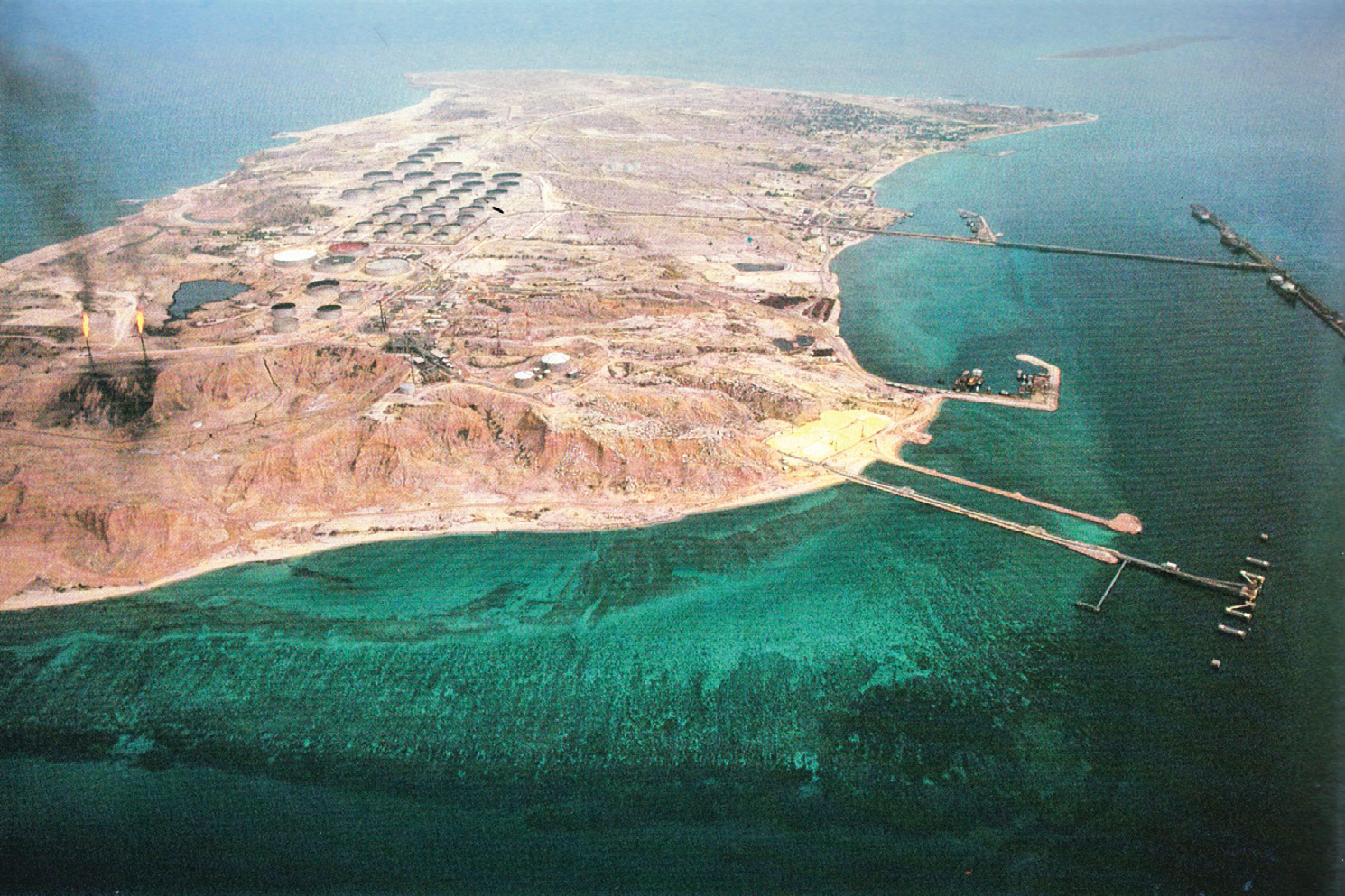
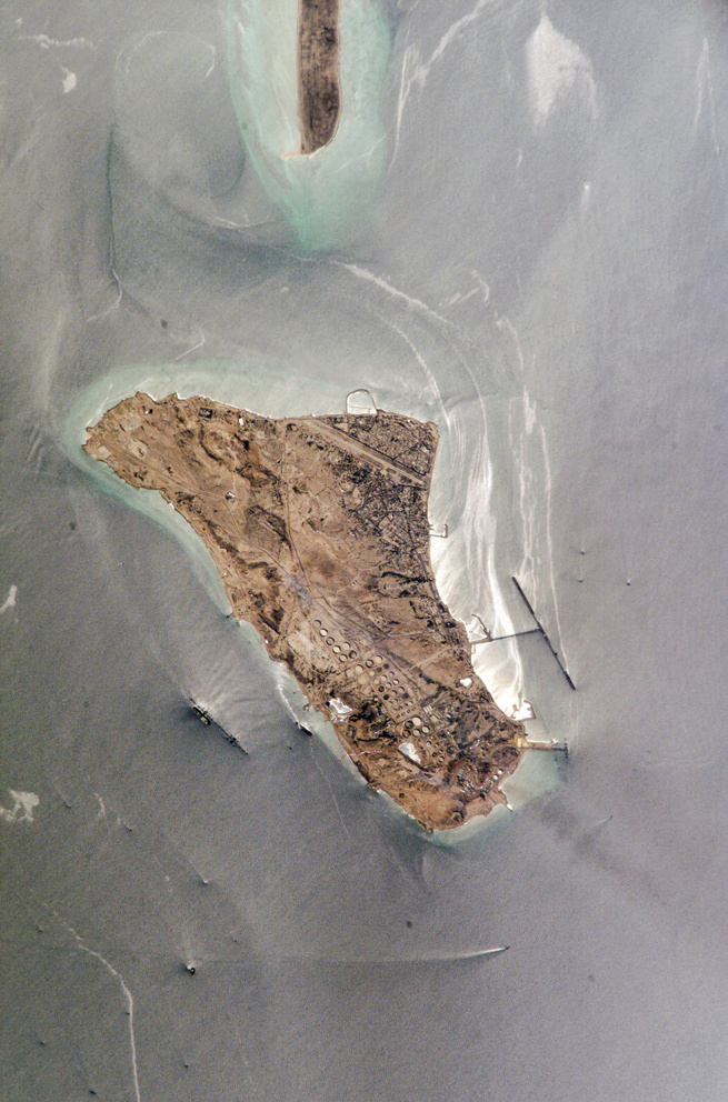
The identity of Khark Island, for as long as our generation can remember, has been defined under the shadow of oil and its adventures. The country's most important oil export terminal — from which nearly all of Iran's export oil (over 90 percent) is shipped to the world via the T-shaped jetties of this island. The way this island is positioned in the Persian Gulf and its elevation relative to the coastal shores of Bushehr province are such that the oil channeled to this island through transfer pipelines follows a natural gravitational flow, and with the help of Earth's gravity, transfer to the export jetties requires less support energy. Khark Island — or Kharg, as the locals call it — is only 46 kilometers from the port of Bushehr, standing merely 3 meters above sea level, yet it is large enough to have mountains such as Takht, Gordan-e Shotor, Lashkari, and Didehban (Watchtower). But this very position and elevation places it in a superior position among the Iranian islands of the Persian Gulf for oil transfer. The island is in fact a gentle anticline whose surface layers have an average slope of 10 to 15 degrees, and Didehban Mountain, at 87 meters above sea level, is the island's highest point. In truth, in the hundred-year narrative of oil, Khark is the endpoint of efforts in Iran's first modern industry and the starting point of the country's global oil trade.
During a trip to Khark that I made while serving at the Physical Planning Office of the Ministry of Roads and Urban Development, I was to accompany a group to arbitrate between the local residents and the oil company — sitting with representatives of the people, the oil company, and the Bushehr governor's office — to see what could be done to improve the urban conditions of Khark. From the very outset, we were astonished to discover that during the tenure of the "Miracle of the Third Millennium," ownership of Khark Island had been transferred to the Ministry of Oil. That is, Khark Island — inhabited for centuries, long before the discovery of oil and the Ministry's arrival — had suddenly, along with all its nature, environment, and people, come under the ownership of a single government ministry, in violation of the rights of the indigenous inhabitants and lacking any clear legal basis.
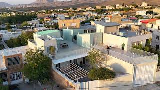
According to the latest census, Khark has a population of 8,196 with a multi-cultural, multi-ethnic, and multi-religious composition. Traditional construction in the northeastern corner of the island features a fabric similar to the architecture of other areas along the northern coast of the Persian Gulf, with the difference that, due to the scarcity of land allocated to local residents, this area has developed a denser fabric: single-story buildings with small central courtyards connected by winding alleys.
In recent years, the same type of architecture seen in other southern port cities has become fashionable in Khark, with building materials mostly imported from outside the island. With the ever-increasing indigenous population, the value and importance of available land on the eastern side of Khark's airport runway grows daily, while the law permits residents only limited construction in this same area. The protest of the local people — who have lived on this island for centuries, even millennia — beyond the failure to employ their educated children in the oil facilities, concerns this very restriction on development and construction. They say the oil company has swallowed the island, confining the city of Khark and its people to the airport area, imprisoning them so that construction needed for the natural growth of the population has been halted. Since the owner, based on its ownership rights, interferes with the island, no room remains for urban development or the implementation of the city's master and detailed plans.
Another surprise during that visit was that every old and young person had a copy of the city's master plan ready in their pocket and, with eloquent speech clearly honed through hours of discussion and debate about this plan and the rights of inhabitants over their city and island, recounted the calamities that had befallen them. Even if we attributed this quick-wittedness to a social campaign by the island's people against the monstrous, shapeless beast of oil, this general familiarity with the master plan and the civic and territorial rights of the indigenous people over their own island was remarkable. The oil company — with its army of pipes and blazing flares, government managers, parliamentary representatives, and limitless money — on one side, and the people of Khark, backed only by a few of their own educated youth, on the other, locked in struggle to find a little more living space for themselves and future generations on that island. These people do not want to leave the island, even though all factors and signs attest that no future has been envisioned for them here, and just as the oil company has imprisoned them in a corner of the island, the indigenous community of Khark resembles a boxer pushed into a corner of the ring who may be knocked down with any blow.
The oil company, through its acquired ownership rights, is busy changing the island's landscape and topography — a matter against which the local people have serious objections. Those who suffered many casualties during Iraq's repeated attacks on the island (Khark was targeted 2,880 times by Iraqi bombers) say that with the Ministry of Oil's aggressive plans, the island no longer bears any resemblance to its past environment and nature. Air pollution from the widespread burning of flares — the sour gases that accompany oil and which Iran currently cannot export or utilize — has spread a perceptible smell across the entire island. Were Khark not an island, it would, like Asaluyeh where children have been born with congenital genetic diseases, have to accept serious mental and physical defects in its children. But even this level of pollution, inhaled in the air, will surely bring harm to the island's residents. The oil company, with bulldozers and massive earthmoving machines, cuts through the island's mountains and hills like cheese to install new facilities, while the people, objecting to the changing face of their ancestral island, are left helpless about what to do.
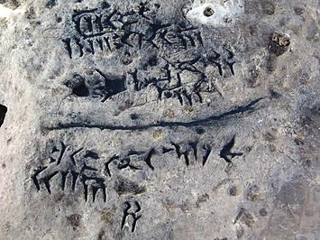
The right belongs to the people of this island — they have been residents here since ancient times, as evidenced by historical remains from various periods of Iranian history. Among these, importantly, the evidence authenticating Iran's southern gulf as the "Persian Gulf" happens to be located on this island: a cuneiform inscription from the Achaemenid period, unique of its kind, which — like Darius's tablet at the Suez Canal — attests to the Iranian identity of these regions from time immemorial. In 1387 SH (2008/09), this inscription was attacked by a person or persons whose apparent aim was to erase this identity document; the greater part of it was scraped away, leaving only a fragment for viewing today. It is here that one must remind the ignorant managers of the responsible ministries how cultural works and historical markers should be protected to consolidate national sovereignty, rather than naively imagining that merely possessing the title deed to an island can, in international forums, substitute for clear historical evidence — inscriptions, tombs, and historical and linguistic artifacts.
Among the island's other historical remains is the Dutch Fort, a relic of the first East India Company, established by the Dutch for trading with India and later for colonizing the East. This fort was built during the occupation of Khark by the Dutchman Niebuhr in 1133 SH (1753 CE), and the Dutch presence in Iran's southern territories sparked resistance movements in the region, which reached their zenith with the struggles of Mir Mohanna and ended with the expulsion of the Dutch from this important Iranian island.
To the north of Khark lies a small, uninhabited island known as Khargo, considered the twin of Khark. Since ancient times, these two islands have been mentioned together in historical documents. Khark's importance on the route extending toward the mouth of the Tigris and Euphrates (Arvand Rud) lies in its role supporting navigation in the Persian Gulf since antiquity. For this reason, many ancient Greek geographers report on it, however vaguely. Ptolemy, the Greek geographer, among the islands of the Persian Gulf mentions two by the names "Tabiana" and "Sophtha," which, given their location directly opposite a place he calls Tao, are identified as "Karak" and "Kargo."
Jean-Baptiste Bourguignon d'Anville,1 the French cartographer who in 1782 wrote a treatise about this island, equated these two islands (also mentioned by Ptolemy) with the islands of "Ichara" or "Ikaros" — names found in the Bible for islands in the Persian Gulf — but after a comparative analysis of the accounts of Strabo, Pliny, and Ptolemy, this identification was rejected. In the maps he produced, he used the name Ichara for the island of Karak — an ancient name similar to modern-day Khark — yet the problem of reconciling accounts by Greek geographers such as Strabo and Pliny with Karak's location persisted. As d'Anville noted, another name Ptolemy probably used for this island is "Sophta."
In 1797, William Vincent,2 the Dean of Westminster, in his scholarly treatise on the islands at the mouth of the Euphrates (Arvand Rud), writes: "Marcian mentions the island of Sophath, Sophta of Ptolemy, which is Karak." A decade later, Vincent raised the possibility that the island is Khark: "...Marcian refers to Sophath, Ptolemy's Sophta, an island that may represent modern-day Karak, and I was seeking a solution to this mystery. But its position is so vaguely defined that I could determine nothing — unless it really is Karak, though I had no doubt that Ptolemy's Arakya, which, based on d'Anville's theories, I had previously supposed to be Larak or Busheab, is probably Karak itself. Since the impossible supposition is not impossible, I take it as a conjecture..."
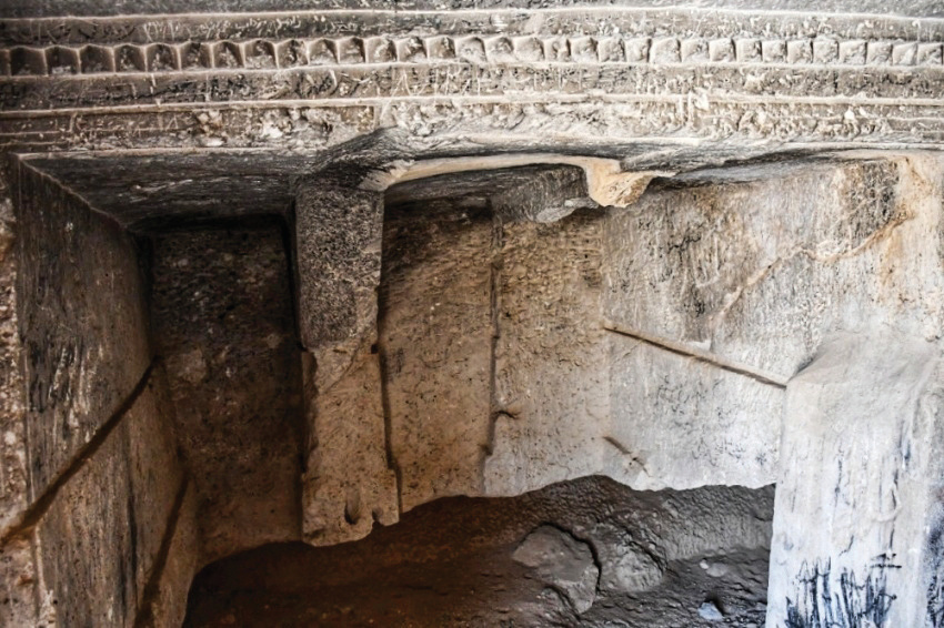
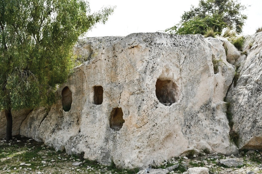
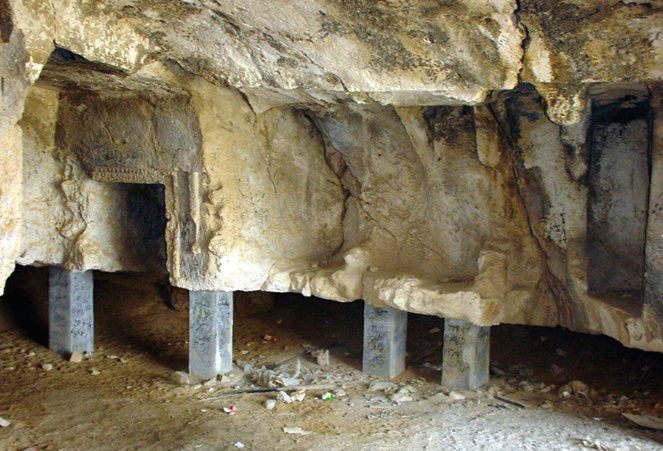
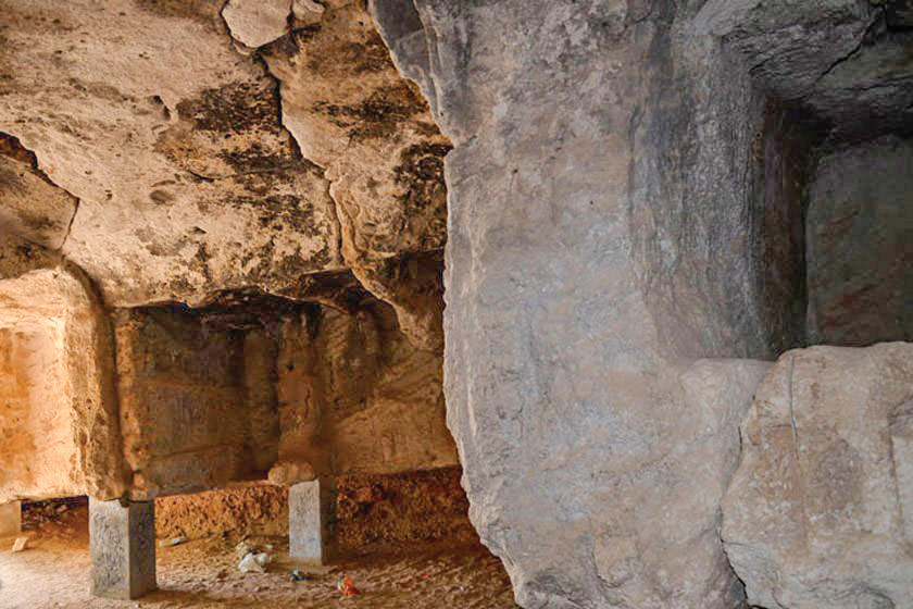
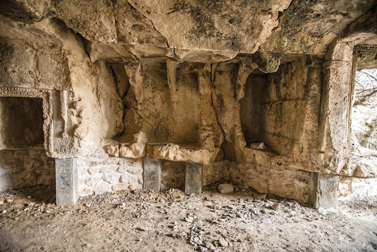
The Palmyran Temple-Tomb
Among the other historical and identity markers of this island is a rock-cut space carved from stone with a distinctive order, also known as the historical cemetery of Khark or the Palmyran temple-tomb. Although no archaeological observation has directly suggested the possibility of it being a Mithraeum, given the excavation of graves in the eastern part of the island attributed to the Sasanian period — and the existence of graves with cross markings far older than the European presence in the Persian Gulf — one can surmise that this rock-cut structure dates to the Parthian period. From this perspective, it is possible that this cave was one of the thousands of Mithraic temples on the Iranian plateau that, like many others, were later converted to different uses.
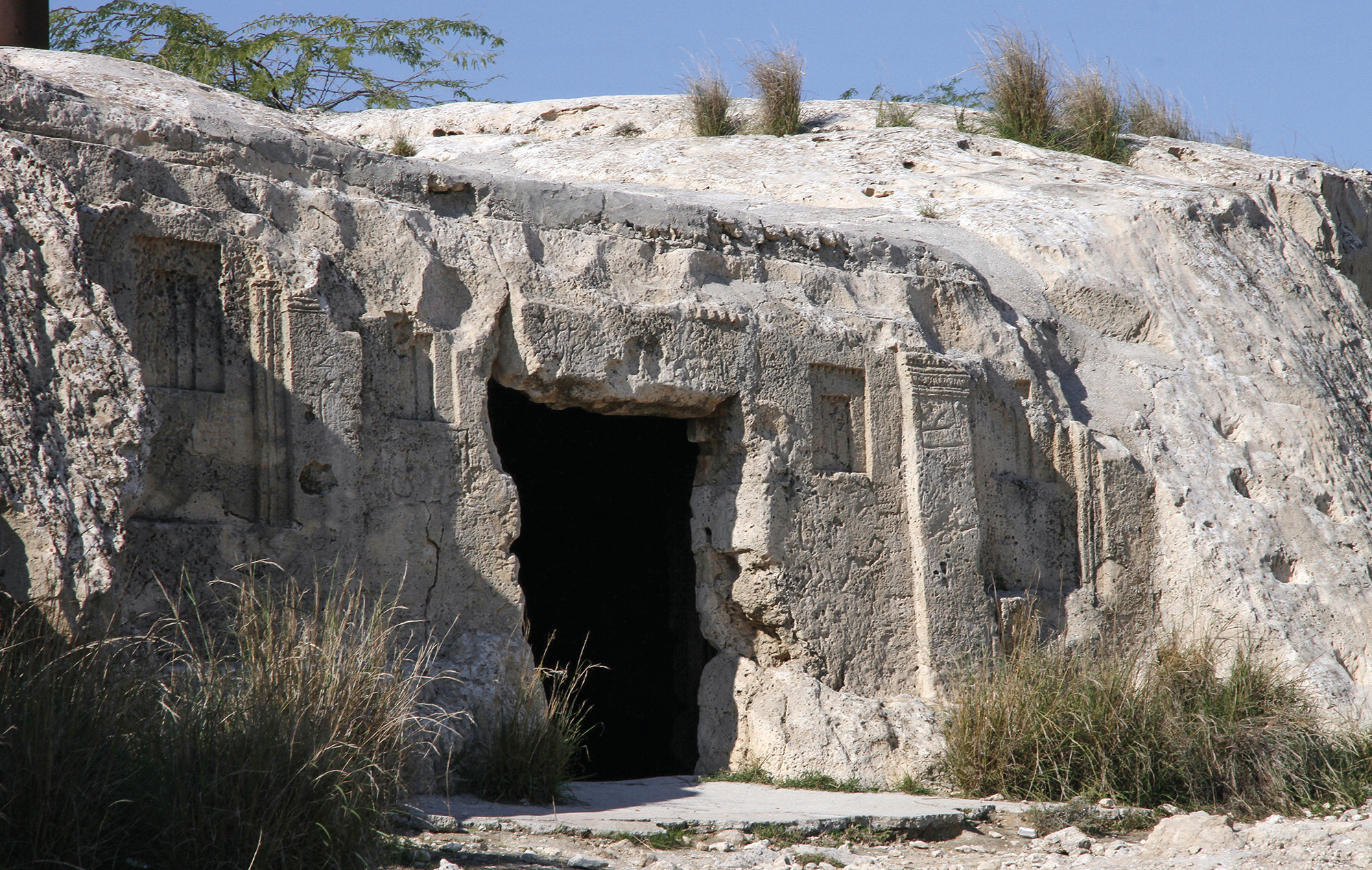
Shrine of Mir Mohammad Hanifeh
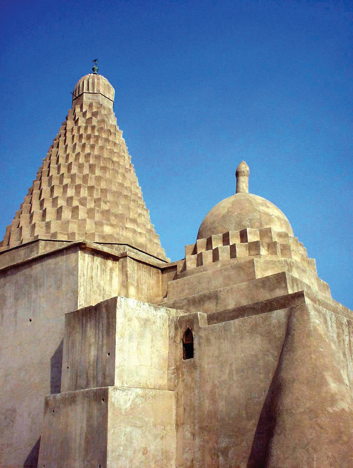
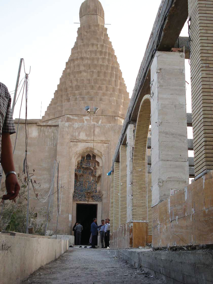
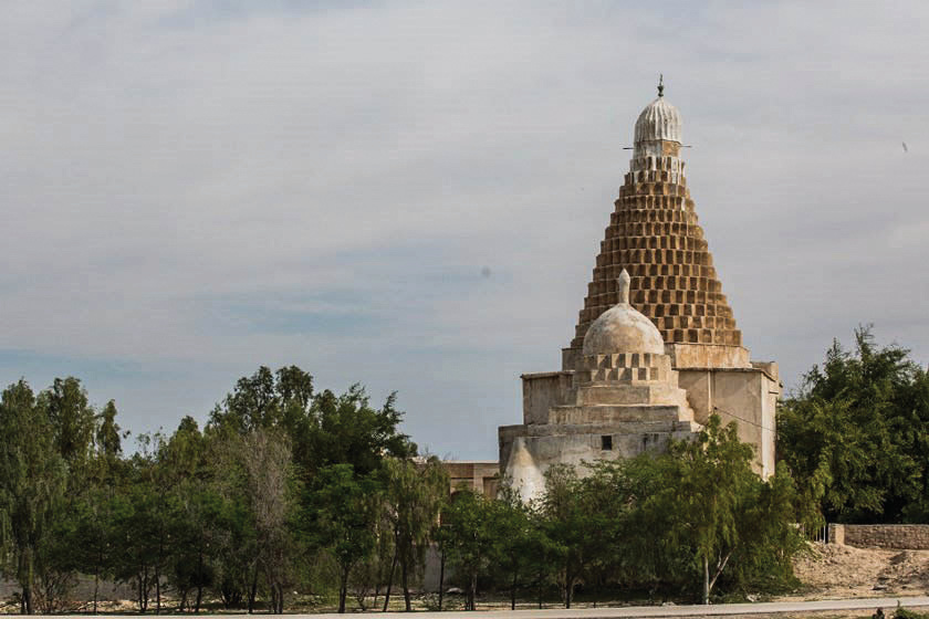
Among the other notable structures on this island is the shrine of Mir Mohammad Hanifeh in the southwestern part, a Seljuk-era building whose construction dates to 738 AH, contemporaneous with the reign of Qutb al-Din Tahmtan, one of the kings of Hormuz who ruled over the islands and coasts of the Persian Gulf and the Sea of Oman. Apparently, this shrine is the tomb of Mohammad Hanifeh, the son of the first Imam of the Shia, who, fleeing the oppression and persecution of the Umayyads during his migration from Medina to Basra, took refuge on this island and was there poisoned and killed. The building is covered with a dome indigenous to southwestern Iran — also seen on tombs such as that of the Prophet Daniel in Susa and Yaqub Laith Saffari in Dezful — featuring a serrated geometry considered, in terms of construction technique, one of the simplest domes in Iranian architecture. In the building's inscription, the builder is identified as Seyyed Ali Bokhari, who, after completing the construction — in an allegory of the death of Sinmar the architect — fell from the dome's height and was buried beside the grave of Mir Mohammad.
Wildlife and Coral Shores
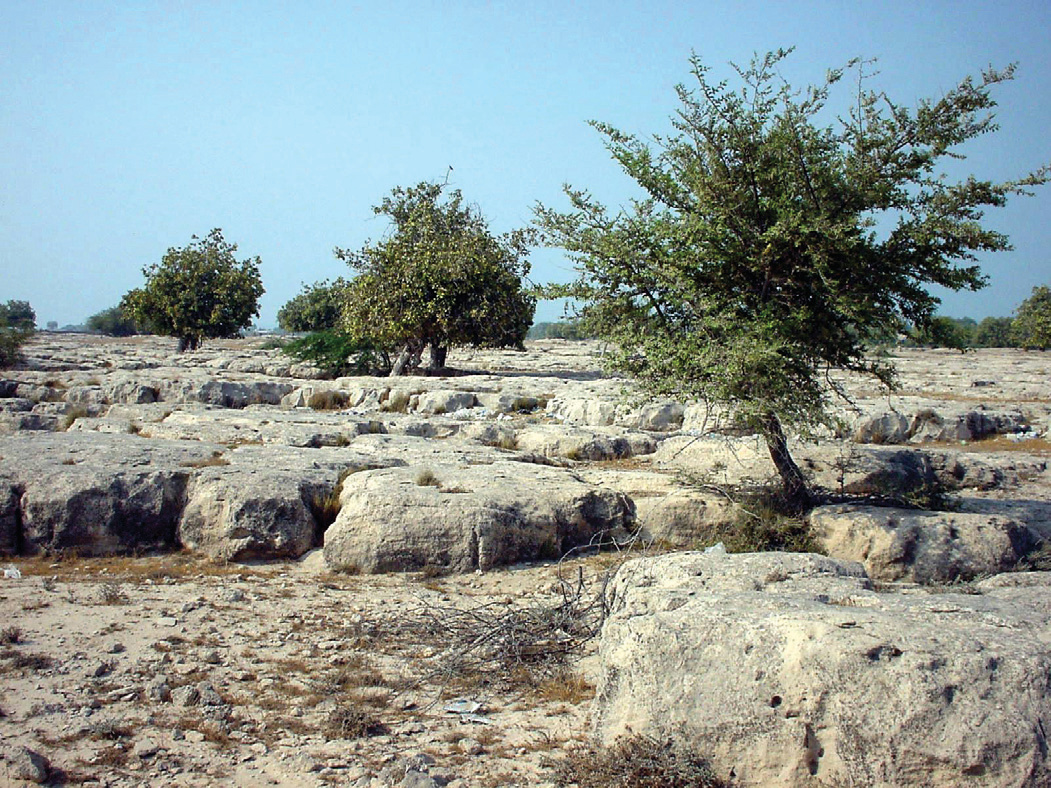
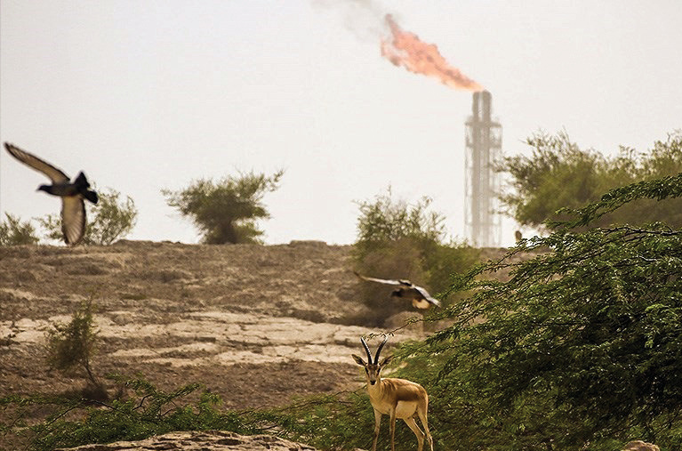
In the author's opinion, among the wonders of this island, the most fascinating is the biodiversity of animal species and its beautiful coral shores, unique of their kind in the country. That numerous herds of deer roam fearlessly among humans on the roads of the oil company's territory is, given the state of wildlife in Iran, astonishing. Without exaggeration, such scenes — which abundantly dazzle every visitor to Khark — are more typically found in protected parks of developed countries like Japan, though Khark Island should also be considered somewhat protected, since travel to it is restricted to indigenous residents and employees of the oil companies that own the island. It is precisely for this reason that wildlife has remained free from human harassment and pursuit. The island's coral shores, at odds with its oily nature, benefit from the clarity and purity of the Persian Gulf waters around the island, especially over the continental shelf, sometimes allowing visibility up to 15 meters deep — revealing an astonishing world of colorful fish and beautiful corals.
Khark Island, with the history and ancient monuments described and with its remarkable nature, more closely resembles a tourist island than an oil terminal, yet all this beauty is held captive by oil, hidden from beholders' eyes, as though it does not exist. As oil and its subsidiary companies day by day diminish and devour this island, the wondrous and historic Khark may, in a few more mornings, bear no resemblance to the days before oil's discovery, and after oil and its industries, all that may remain of this island are smoke-blackened rocks and sheared-off mountains. The geological structure, climate, and plundering economy of today's Iran are so intertwined that before long, nothing will remain of Iran's environment and historical heritage. It is therefore imperative to see as much of this land as possible, for it may no longer exist.
1 Jean-Baptiste Bourguignon d'Anville (1697–1782), French geographer and cartographer.
2 William Vincent (1739–1815), Dean of Westminster and author of scholarly works on ancient geography.