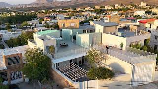
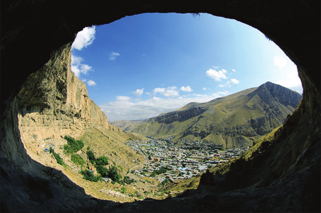
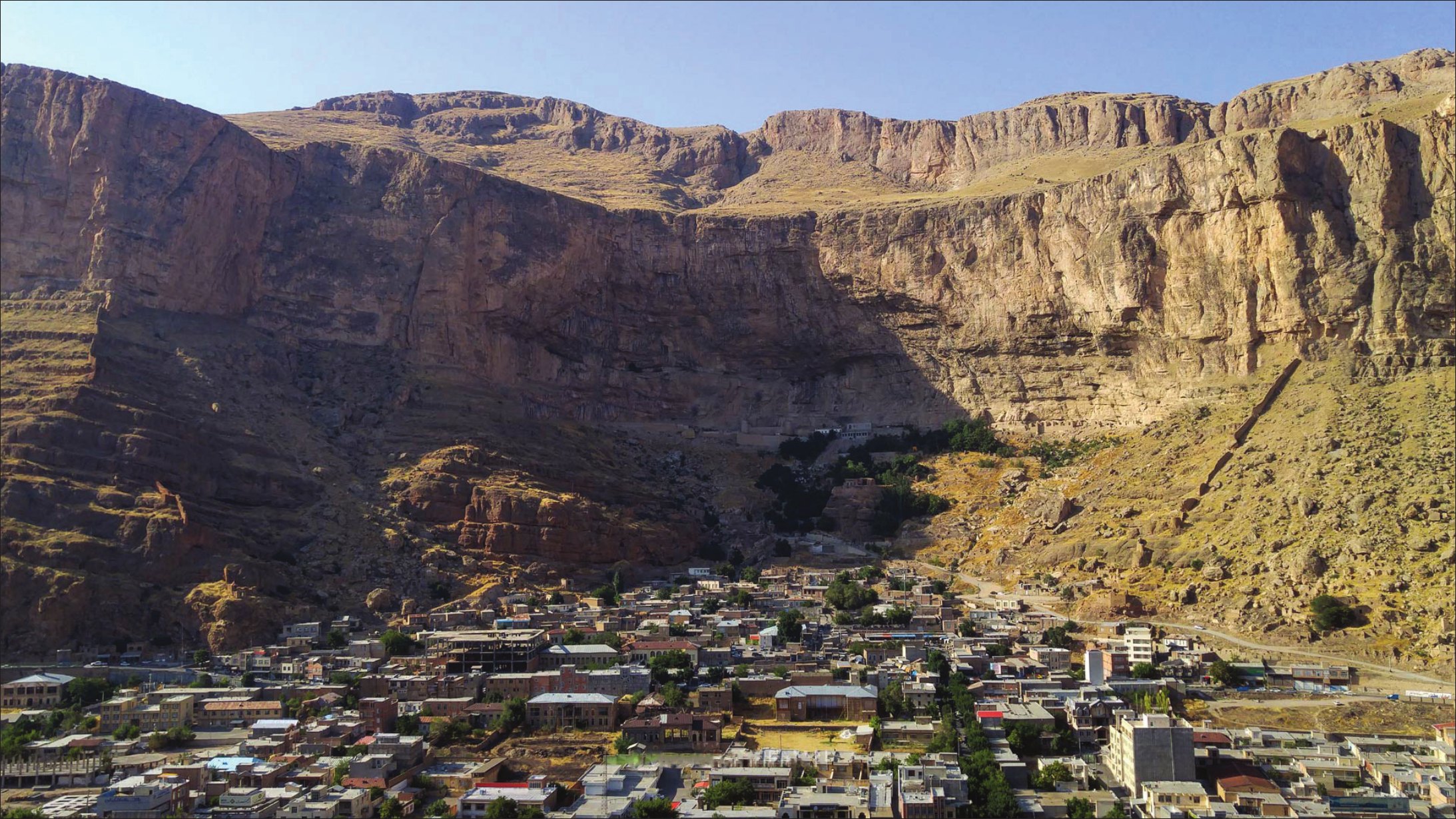
As you approach Maku, a winding road passes through a narrow valley, in the middle of which flows a river called the Zangmar, tumbling down again and again in small roaring waterfalls. At one of these bends in the mountains, the view of the delightful and astonishing town suddenly appears before your eyes.
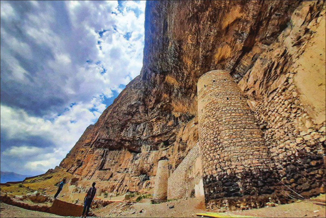
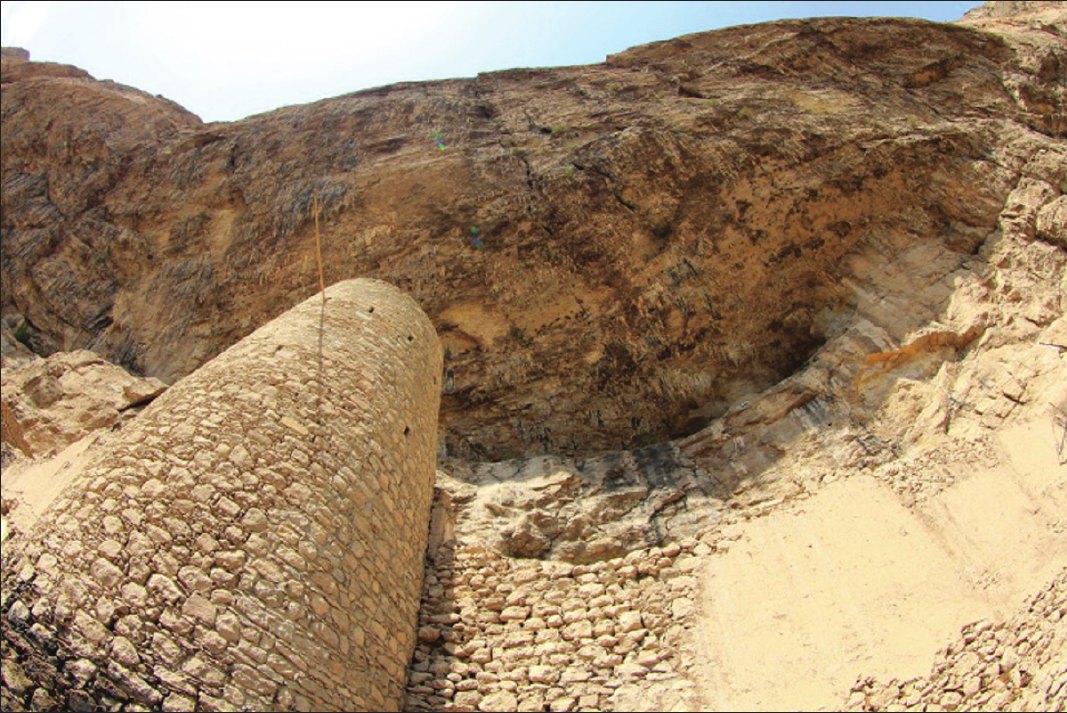
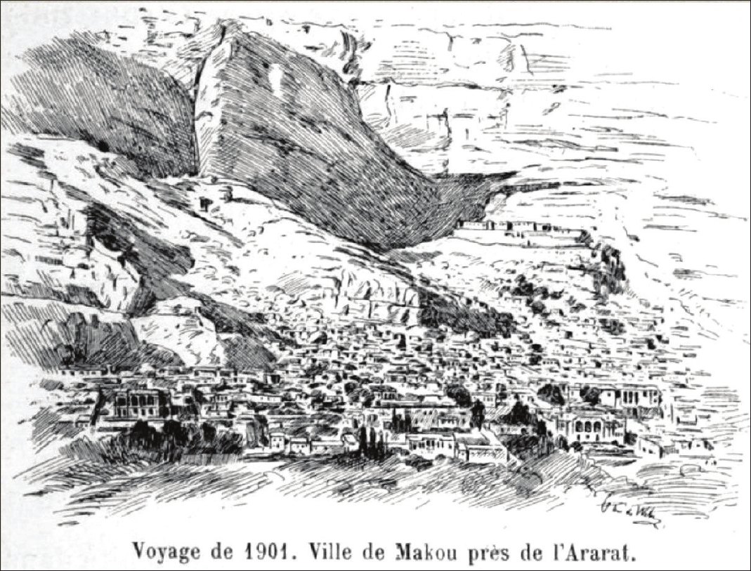
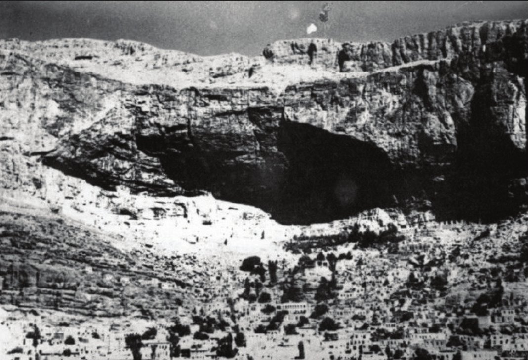
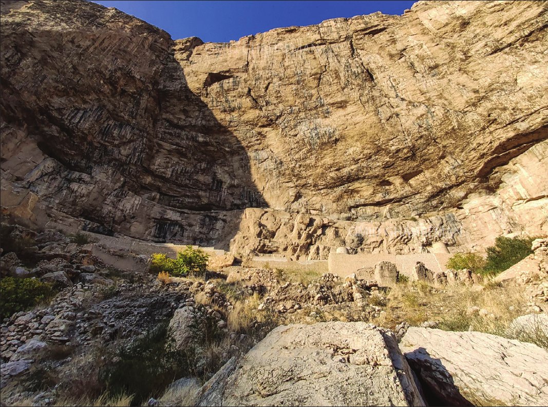
The bare, rocky mountains suddenly rise skyward on both sides, lifting their necks thousands of feet high. The mountain on the right bulges out the higher it climbs and spreads over the town like a canopy; in the hollow of the rocks a castle has been built with a most fearsome facade, surrounded by a wall. In the shadow of the mountains and rocks, buildings have been built in different periods, the most prominent of which date from the Qajar period, draw on the architecture of the Caucasus and are in the care of the Cultural Heritage Organization. Beyond them, it is as if the houses and buildings have literally sprouted; without any rule or order... . This town, full of secrets and mysteries, is our birthplace.
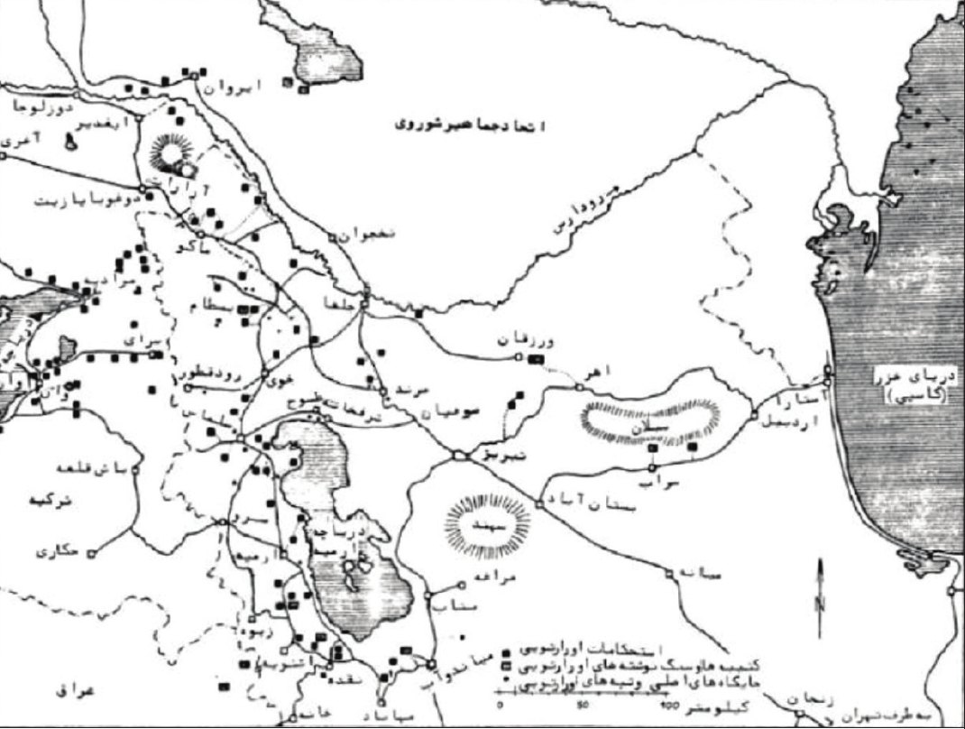
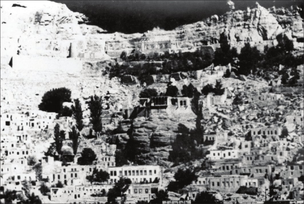
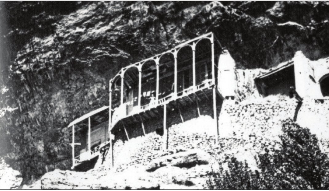
The History of Its Origins
Since no complete archaeological excavation has yet been carried out on this complex, in this section we have no choice but to review the existing historical accounts. Among the historical works and accounts, the Russian archaeologist Minorsky, in his treatise on the history of Iran and with reference to Armenian and Persian texts, dates the history of the castle to long before the arrival of the Turks in Azerbaijan.
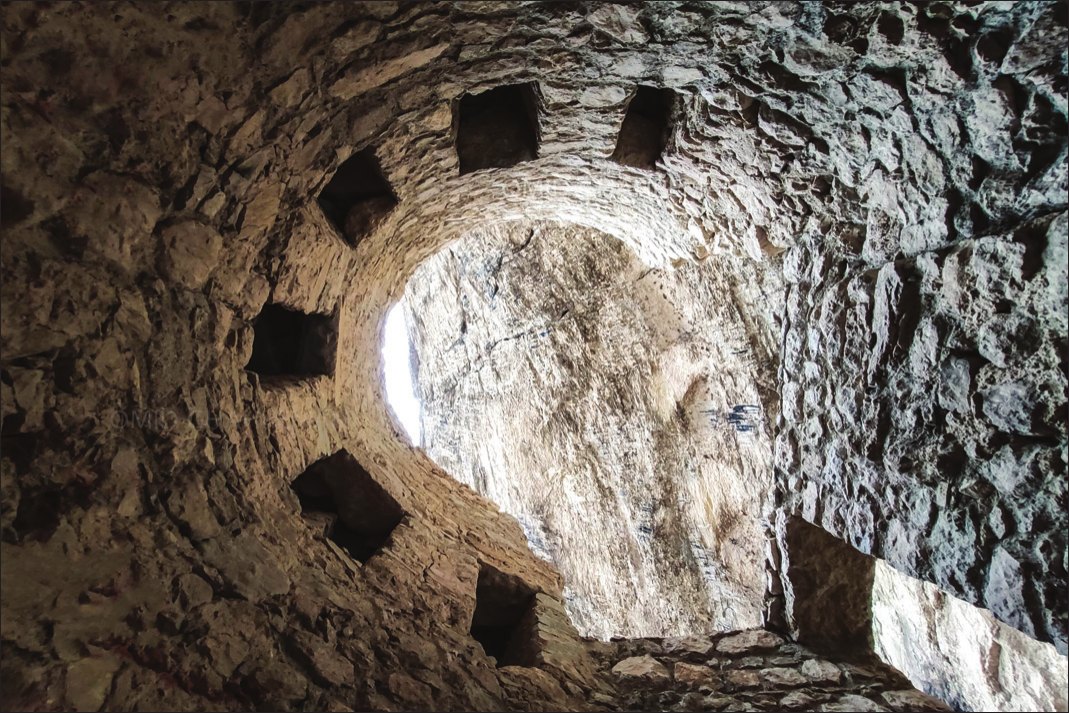
He also refers to a town called Ghapan or Ghaban (Kapan) in Armenia and adds that in Armenian ghaban means a closed and impassable place, or a difficult passage between mountains; and he concludes that, given several centuries of Armenian rule in Maku, ghaban is an Armenian word and the castle has existed since very ancient times. He also counts the caves and passages above the castle, in the heart of the mountain, as unnatural and man-made.
The Original Core of the Town of Maku
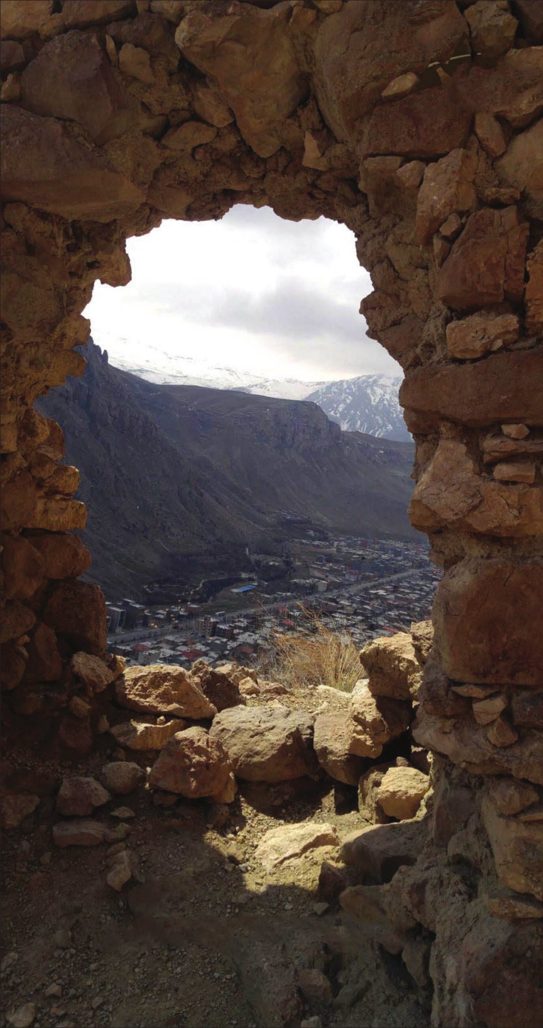
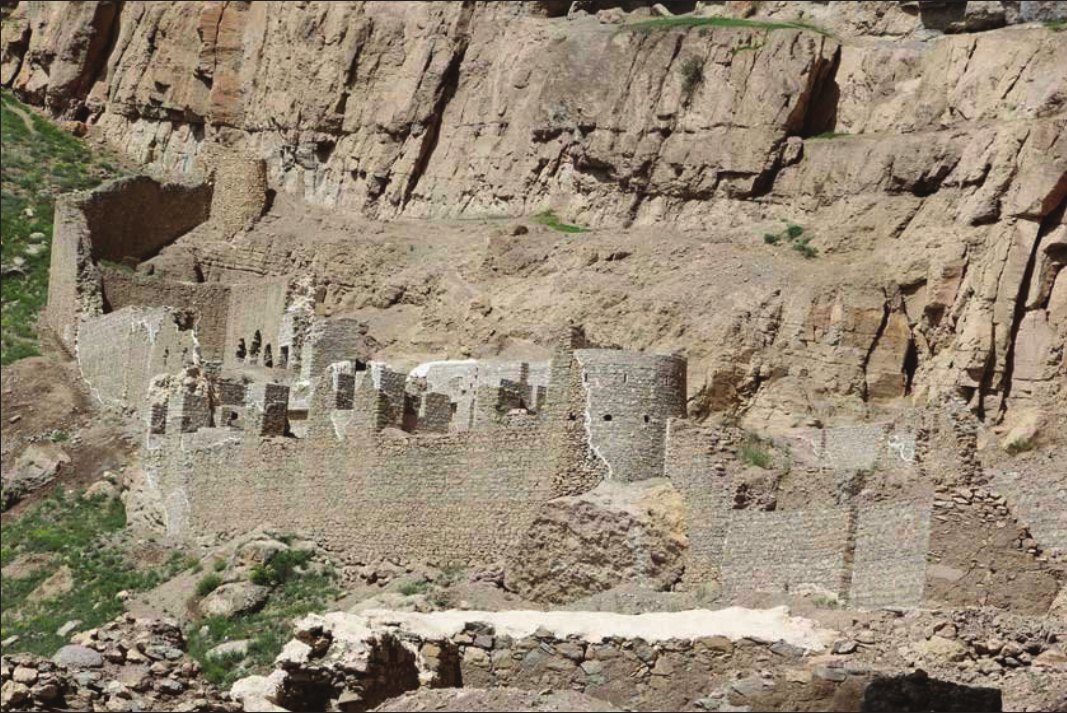
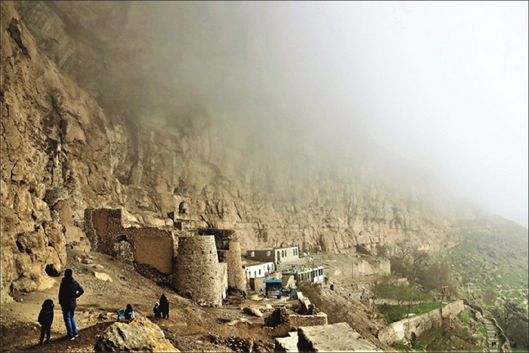
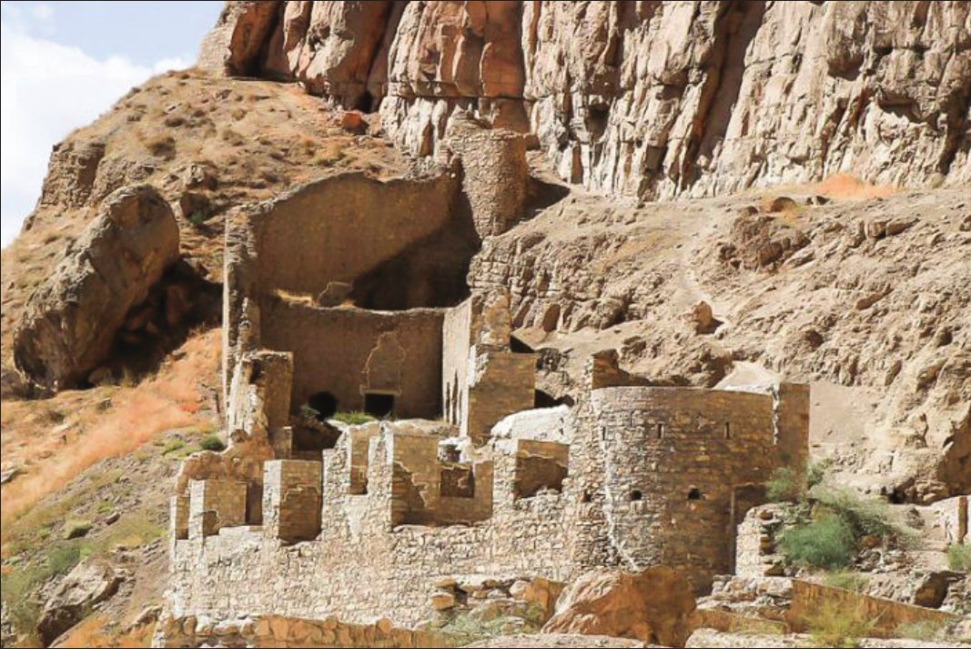
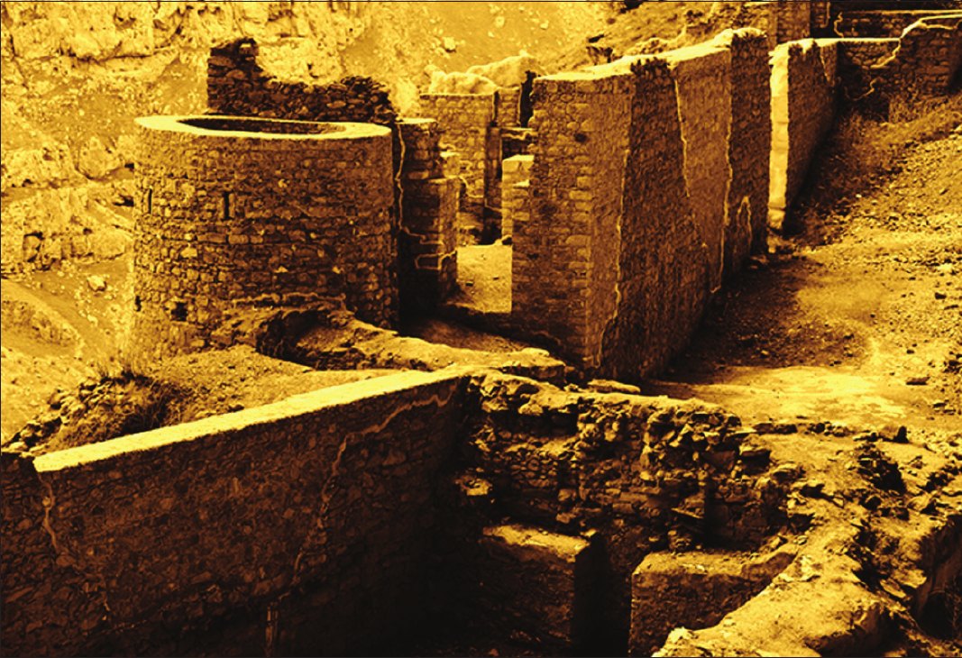
The Ghaban Castle is the original core of the town of Maku; it lay beneath the Qiyeh Dagh mountain, and today only its ruined walls remain. This part of the town is not habitable in its present state, and most of its dwellings are built of mud brick and wood. Although military and defensive factors played the most important role in the creation of the original core of Maku, the settlement and growth of the town also followed natural and environmental factors.
Maku is one of the country's unique regions, displaying a blend of history, nature and culture in one place. Historical evidence shows that this town has always been a border town for the land of Iran and was regarded as the gateway into the Iranian plateau. Given the town's strategic position, to understand the origins of Maku one must look for the original castle, the Ghaban Castle, whose existence may perhaps be attributed to the time of the Medes and even earlier, and which is among the region's important natural, historical and cultural landscapes.
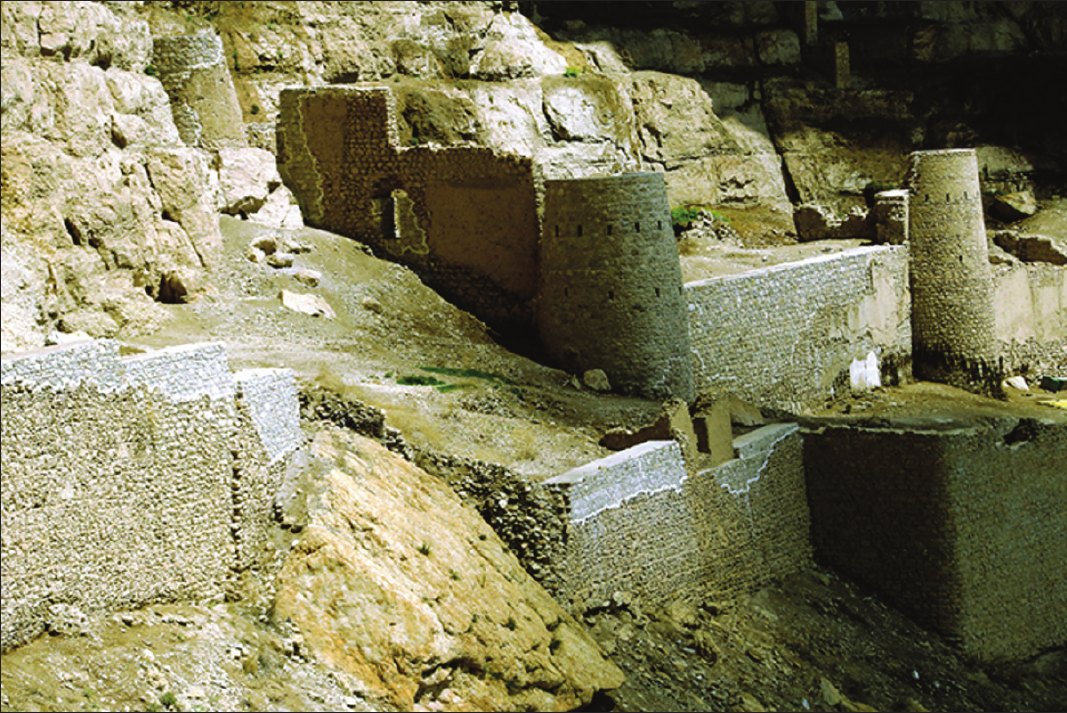
Over the past years, this complex has suffered extensive damage as a result of various events and neglect, and despite potentials that could ensure its beauty, development and progress, today we are faced with a dreary landscape of abandoned and ruined buildings without any particular quality or notable use.
The Ilkhanid Period
In 715 AH/1315 CE, Bishop Zakaria and his brother Petros obtained the political and religious rule of Artaz (parts of the Armenian province of Vaspurakan) and, at great expense, fortified the castle of Maku, which was their residence, and built caravan roads and bridges along the routes. In this way they turned the town into a commercial and strategic route, so that the position of Maku and its defensive fortifications aroused the wonder of onlookers, and the Armenian princes of Artaz ruled for more than a hundred years, relying on the wall and four bridges, or arched vaults, over the river of Maku (the Zangmar). Today an inscription dated 1318 CE on the body of a bridge two kilometres from Maku gives information about the Zakaria family.
The Turkmen and Timurid Periods
Ruy González de Clavijo, in the autumn of 1403 CE/805 AH, set out at the head of a mission on the orders of Henry III to meet Timur, who had settled in his winter quarters in Karabakh. During a visit to the town of Maku he writes a complete description of this town:
According to this historical document, the entrance to the castle was a gate and a tall tower along steps that had been cut into the rocks. Unfortunately, determining the exact location of the gate has not been very feasible, owing to the destruction of the complex and the lack of sufficient documents. However, on the basis of images that survive from later periods, we have located the gate in the east of the complex, at the site of the present mosque.
The hierarchical structure of the town of Maku closely matches the structure of ancient Iranian towns, although the overall form of the town did not follow that of ancient towns (circle and quadrilateral), the reason for which can be sought in its environmental and natural setting. The hierarchy of this ancient castle-town comprises the kohandezh (citadel) at the highest point of the town, which was the residence of the lords and was separated from the other parts of the town by a wall. The sharestan, where the ordinary people of the town lived, was enclosed by another wall, and the rabaz lay outside the two walls of the town and was the place of farming and gardens. The map below is an overall diagram of the structure and approximate extent of the town of Maku in the Timurid period, drawn on the basis of Clavijo's historical text and the remains that survive today.
The Safavid Period
Among the historical accounts of the Ghaban Castle in this period is the description by Eskandar Beg of the Kurds of the Mahmudi tribe and of the secretary Mostafa Beg, which concerns the conflicts between the Iranian and Ottoman states in this period and the rebellion of the Mahmudi tribe in the castle of Maku. Eskandar Beg writes: "Mostafa Beg, the governor there, went with his kin and followers to the castle of Maku, which lies at the foot of the mountain, in the middle of the valley, and which, owing to its utmost height and the closing of the way, no man of power has ever laid a hand upon, and took refuge there; and the other castle, at the foot of the mountain, which was his main residence, he also fortified, placed his baggage and loads in that castle and appointed a group to guard it. Shah Abbas ordered the Qaradaghlu and Moqaddam tribes to conquer the castle at the foot of the mountain, and that same night those men surrounded the castle, reached the foot of the wall, made holes with mighty blows and poured into the castle. Since the conquest of the castle in the middle of the mountain was not easily possible, it was ordered that the army should not at this time turn to conquering that castle, and that if the Mahmudi rebels dared step forward and undertook to fight and do battle, they should be given their due."
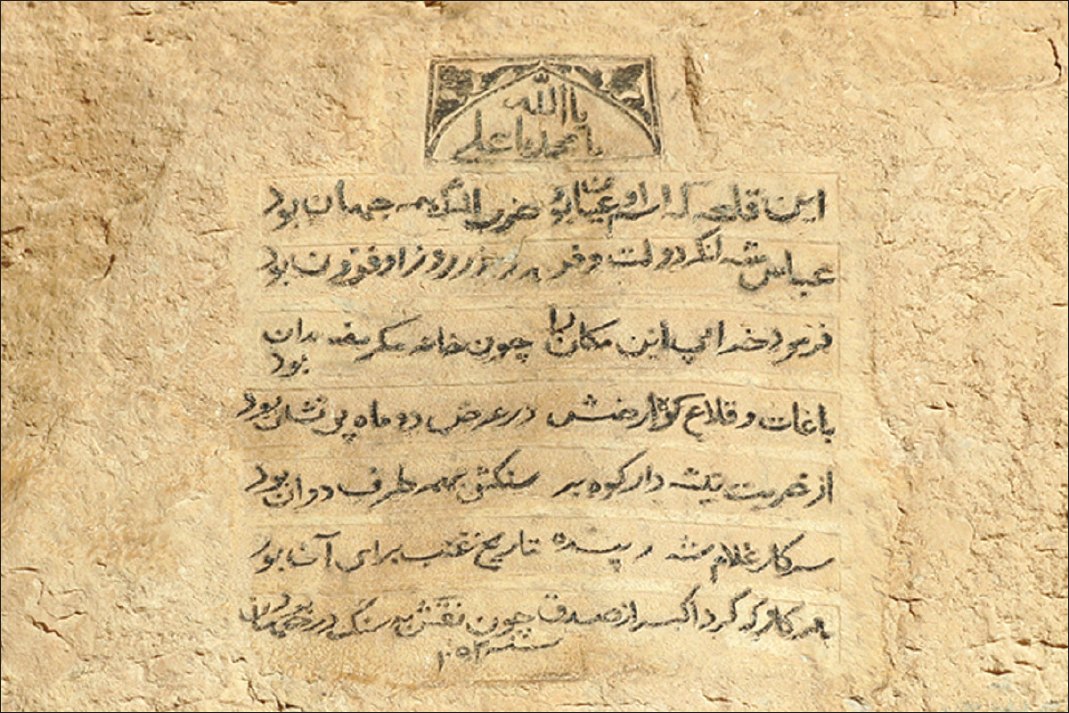
Also in this period, in the time of Shah Abbas II, in 1052–1070 AH, under the peace concluded between the Iranian and Ottoman states, it was agreed that the castles of Qotur and Maku be destroyed by each side.
The Qajar Period
In this period, unlike earlier periods, many descriptions of the town of Maku have survived from European travellers because of their numerous journeys to this region. But in them they mostly refer to the general features of the town and do not deal with the details or the architectural structure of the town and the castle. Nevertheless, by examining these historical texts and comparing them with the surviving image from this period, one can to some extent learn about the condition and extent of the town.
Alcock's Descriptions of the Town of Maku
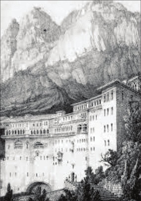
In his travelogue and descriptions of Maku, Alcock is so impressed by the wondrous atmosphere of the Ghaban Castle and its natural setting that, to convey the feeling of the place to the reader, he compares it with a monastery in Greece called Megaspelaion, built inside a rock, and considers the wonder of the castle and the effect of its setting ten times that of the monastery; today nothing remains of it but ruined walls. The Megaspelaion monastery in Greece, whose original core took shape in 362 CE, takes its name from a cave in the same area and has witnessed many events and much plundering throughout history. The monastery's modern, eight-storey building of today bears little relation to its historic structure.
Colonel Monteith's Descriptions of Maku
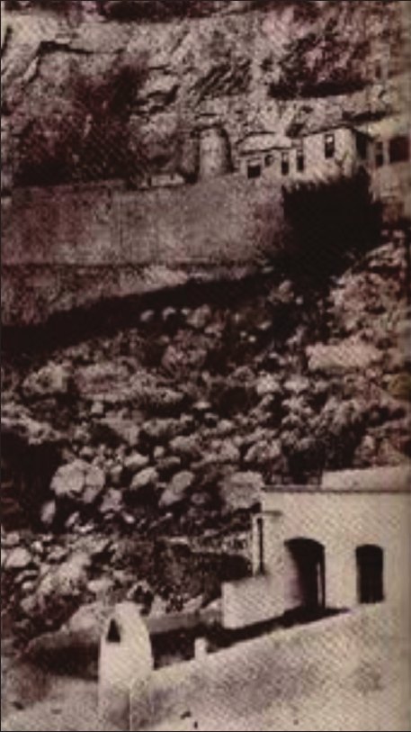
In this writing, Colonel Monteith describes the structure of the castle as modern but does not deal with its architectural and physical details. The modern structure of the castle at this juncture raises the possibility that the castle was rebuilt and fortified in different periods. According to this historical text, there were 400 houses in the town of Maku in this period, most of them built outside the area of the Qiyeh rock; in his report Colonel Monteith attributes this to the frequent rockfalls in that area. Like his travelling companion Alcock, he too refers to the town's perimeter wall, which stood through different periods, and describes it as a low wall that protects the houses of the town.
According to historical documents of the late Safavid period, at the beginning of the reign of Shah Abbas II (1632 CE), 300 households of the Bayat tribe migrated to Maku; given the number of existing houses, a little reflection shows that the town did not grow or develop much over these 200 years, and that the town's main expansion most probably took place in that same period and up to the limit of the perimeter wall.
- 1828 CE, 1207 SH — Thomas Alcock: described Maku in his book titled Travels in Russia, Persia, Turkey and Greece, comparing Maku with Megaspelaion; this book contains the first pictorial document of the town of Maku.
- 1832 CE, 1211 SH — Colonel William Monteith: was a British soldier, diplomat and historian. He accompanied Major General Sir John Malcolm in Iran. Re-creation of the Russian borders on the Aras.
- 1840 CE, 1219 SH — James Baillie Fraser: a Scottish writer and artist who illustrated and wrote about Asia Minor and India.
- 1849 CE, 1220 SH — The journey of John William Parker, published in the Saturday magazine
- 1851 CE, 1230 SH — Eugène Flandin and Coste: together with the noted architect Pascal Coste, on a two-year journey to Iran, left valuable images of the buildings and towns of Iran.
- 1882 CE, 1261 SH — Mirza Mohammad Ali Mahallati, known as Haj Sayyah, described Maku in his book of memoirs.
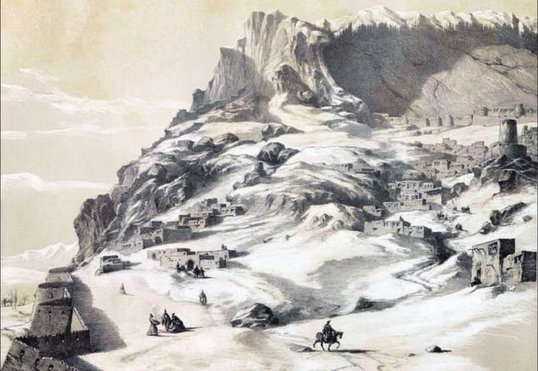
James Fraser's Descriptions of the Town of Maku, 1840 CE
The castle is built at a height of about 200 or 300 feet above the valley, and below its wall, on the slope, the town or village is built among stone ruins onto which every now and then a stone falls from its vertical cliff. The whole town is also surrounded by another wall, which at one point joins the rock and the castle wall. This wall is reinforced with towers and square bastions.
It seems that the space between the castle wall and the rock cannot be more than 60 or 70 feet deep, so the place it creates for habitation must be small. But there are other cavities inside the rock that are accessible only by rope. These passages lead to caves, and I am sure their capacity is more than a thousand to three thousand people. The castle has storerooms that have always been full of food, and there is a spring inside the castle for the people's use. The inaccessibility of the inner parts of the castle, unreachable even with cannon and rifle, shows that the castle is entirely defensive and impregnable. Inside and on the caves there are many rock inscriptions in an unknown language that have not yet been fully studied.
Eugène Flandin's Descriptions and Painting
In this description, Eugène Flandin refers to a town with two walls, matching the same urban structure that Clavijo described in the Timurid period; that is, both walls (the castle wall and the town's perimeter wall) were still standing in this period. He also speaks of three elevations within the town, on which tower-like buildings were built that served as watch posts. Looking at his painting of the town of Maku and matching the image with this historical text, two tower-like buildings can be seen in the middle of the town that look like the towers of the town wall. So a military function for these towers is not far-fetched. Up to this period, the landscape of Maku was shaped by the town's natural and historical landscape, which turned it into a unified, defensive, fortress-like, introverted and unique landscape. The existence of three other freestanding towers on the heights of the town, alongside its centralized and introverted structure, was for greater protection. As Flandin says, these buildings were built in such a way as to prevent the Kurds from attacking the foot of the wall.
Eugène Flandin's description of the town's entrance as a winding, uphill route strengthens the possibility that the castle gate lay in the eastern part, at the end of the route of today's steps. The route of today's steps, which have recently been rebuilt, is the route of movement toward the castle and coincides with the historic route. Although the inscription surviving from the Safavid period and other historical documents report the destruction of the castle in this period by Shah Abbas II, the pictorial documents and historical texts of this period speak of an intact and magnificent castle. So, on the basis of the historical sources of this period, two possibilities are proposed to resolve the contradiction. The first possibility is that the castle was rebuilt after the Safavid period; the second is that what was meant by the destruction of the castle in the Safavid period was the second castle (the caves inside the mountain) or the castle's perimeter wall, and that the castle at the foot of the rock was not completely destroyed. In another part of his descriptions, Flandin speaks of a qanat, a caravanserai and a bazaar in the lower part of the town; these descriptions confirm that the town extended in this period southward as far as today's Taleqani Street.
Descriptions of John William's Journey, 1841 CE
We reached a cave called Maku. This very large cave is more than a thousand feet wide and more than 600 feet deep and could shelter the entire population of Maku in an emergency. The road leading to this cave is very difficult, winding and uphill, so that I could hardly keep my saddle balanced. The rocks and mountains surrounding this area create an eerie and romantic atmosphere. This castle has many caves and hidden passages in the heart of the mountain that are accessible only by rope. It is said that these hidden caves are also among the properties of the khan of the region. In this region there is a very unique bastion and military castle called Maku, set beside the river. On the left of the river the mountains rise vertically to a height of 500 feet, and from a point about 50 feet below their peak there is a cave formed by the inward slope of the rock. Across the whole of this gap a stone wall has been built. This cave encloses part of the ground on which a government fortress has been built. Beside the castle there is a second cave in the vertical face of the rock that leads to secret rooms and granaries. This place is the largest store of supplies for the people and the soldiers, and it is a hidden and secret area. It is said that this fortress was the work of Armenians in the very distant past, who built this castle for protection against invaders.
William Daniell's Drawing of Maku
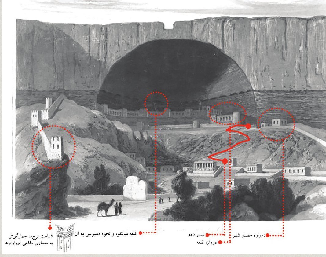
The information from Alcock's journey is valuable in that it led to the drawing of the first pictorial document of the town of Maku. An image that may not seem very realistic at first glance, but contains useful information about this old town. Looking closely at the image, one can extract details of the structure of the town of Maku that also match historical texts from before this period, including Clavijo's writings.
The first point gathered from this image is the existence of two walls in the town: the first wall around a castle at the foot of the rock, and the second wall around the town, of which only the eastern and western sides, stretching up to the tops of the hills, are visible in this image. A notable point about the town wall is its square towers, which differ from the towers of the inner wall. These towers also differ from the towers that Flandin drew years later in his painting of Maku. Flandin drew the towers of the outer wall as round, and traces of some of these towers can still be seen today in parts of the town. It should be noted, however, that during field surveys remains of several walls were observed that match the towers and battlements drawn in William Daniell's painting. Looking closely at the details of these square towers, a resemblance between their details and Urartian defensive works can be discerned, which strengthens the possibility of attributing the castle to this period of history. On the right side of William Daniell's painting, on the eastern side, a gate for entering the castle with a tall tower can be seen, a gate that Clavijo also mentioned in his travelogue.
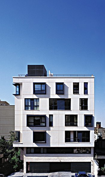
Torna Residential Building
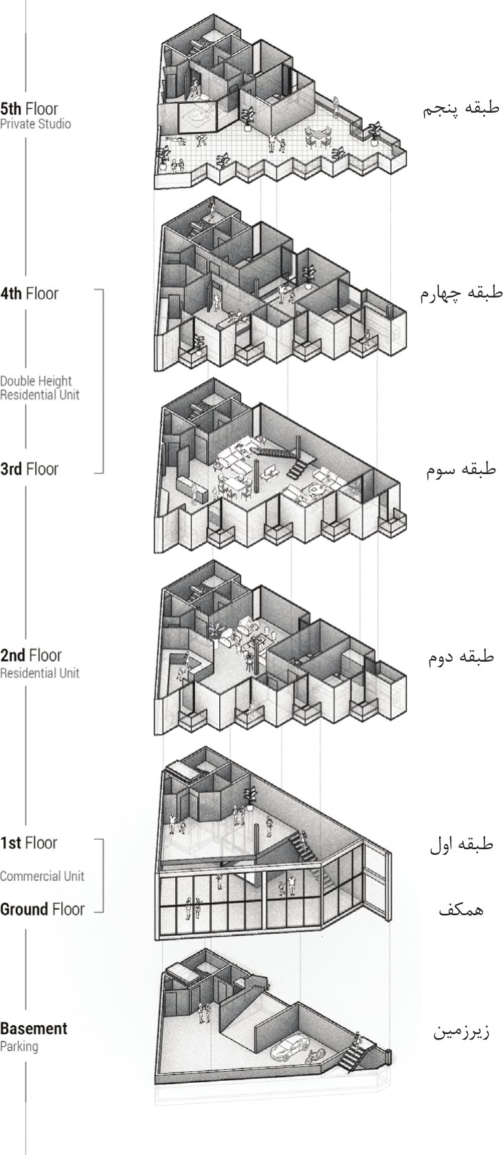
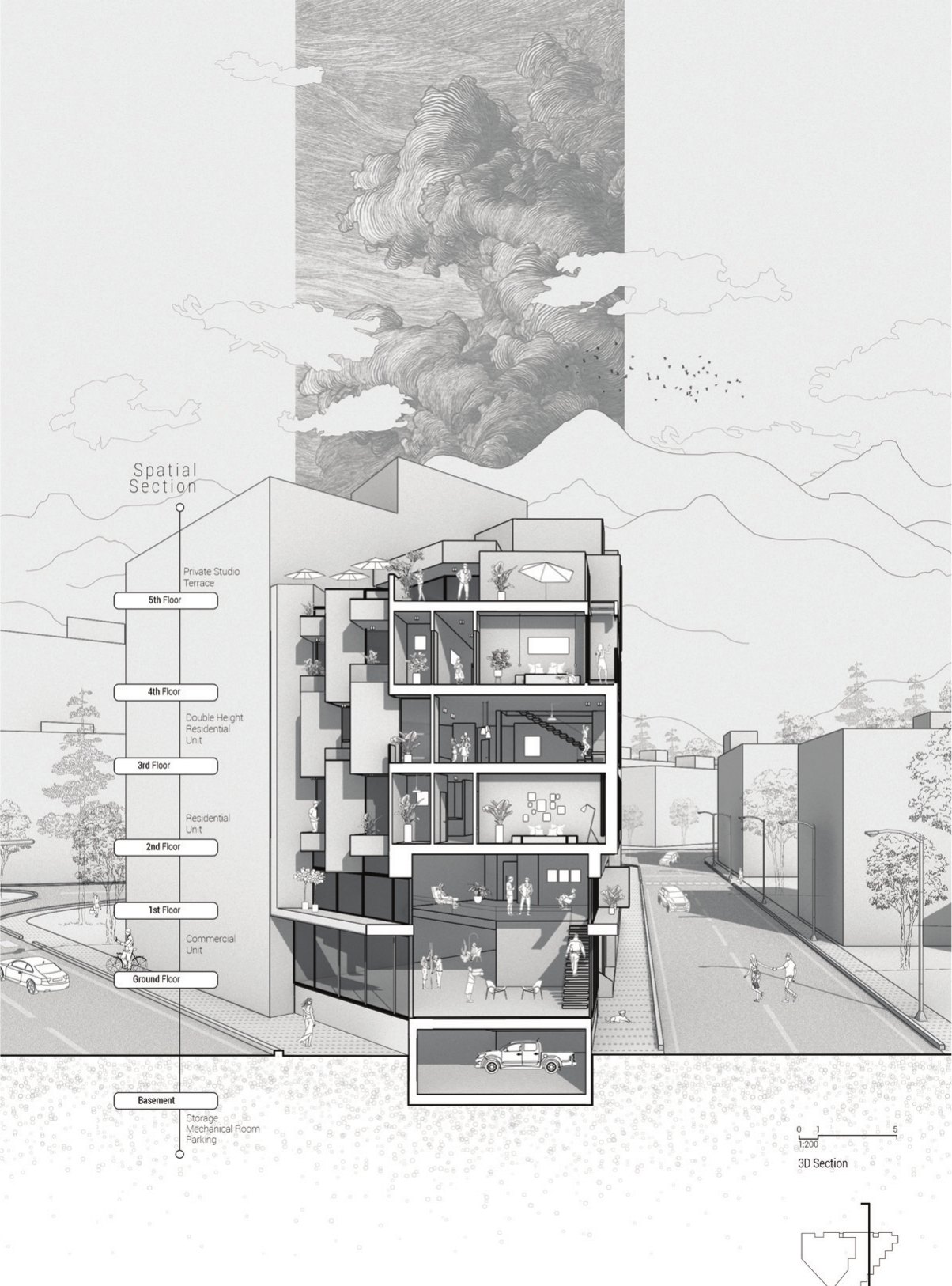
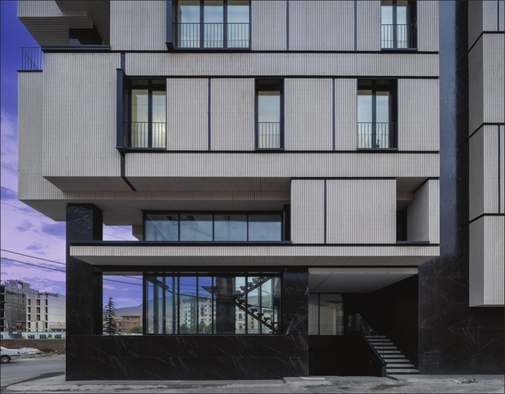
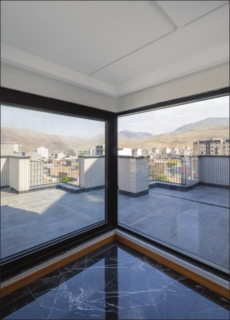
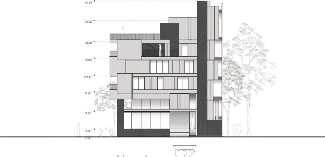
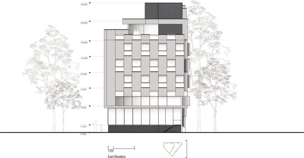
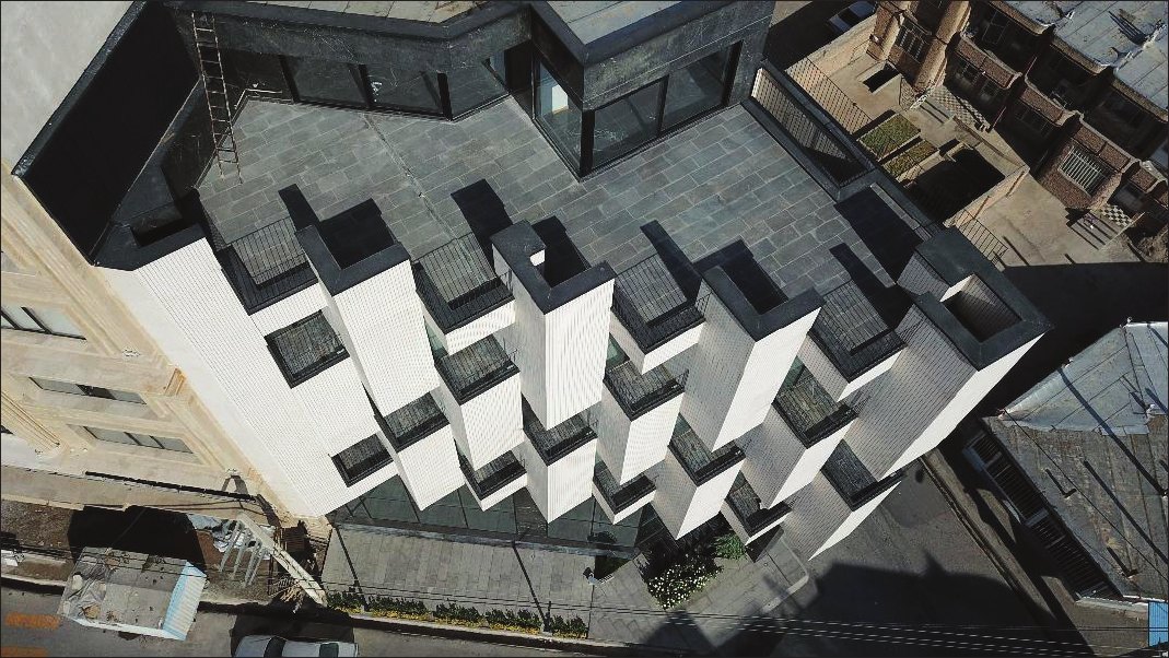
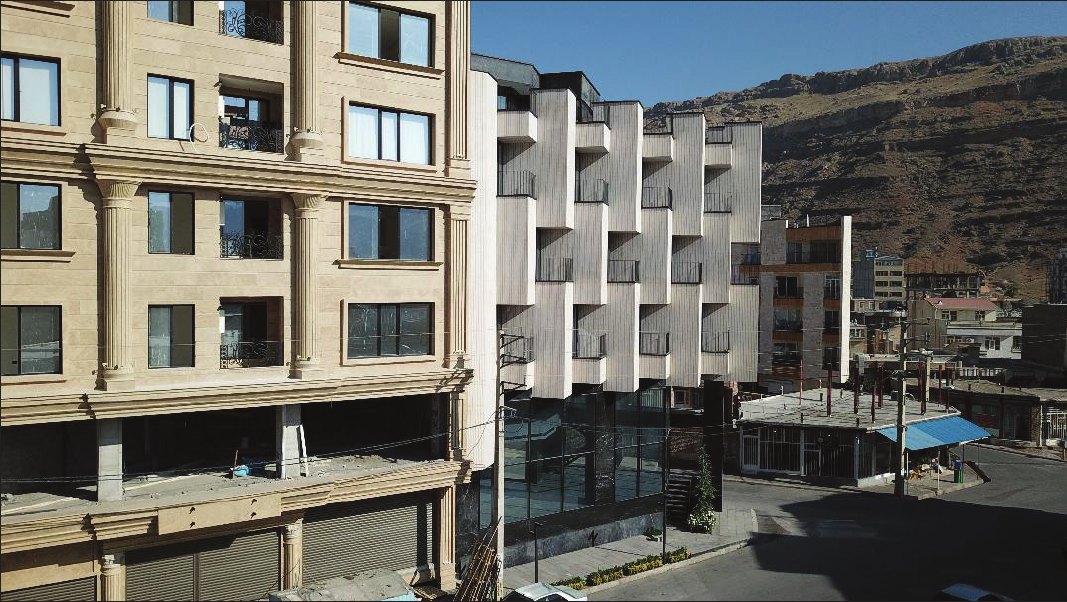
Torna was created in one of the relatively busy spots of the border town of Maku with the aim and vision of raising the citizens' and residents' view of architecture and the urban frontage. The small dimensions of the site and the relatively limited geometry of the project led us at the outset toward a form-making and the definition of a module, and two overall patterns resulting from the repetition of this module. We chose the cube (a frequently repeated form in the historic architecture of mountain regions) as the dominant and main module, and made the technique for shaping the volume and overall form the advancing and receding of the module, in response to elements such as light, view and climate.
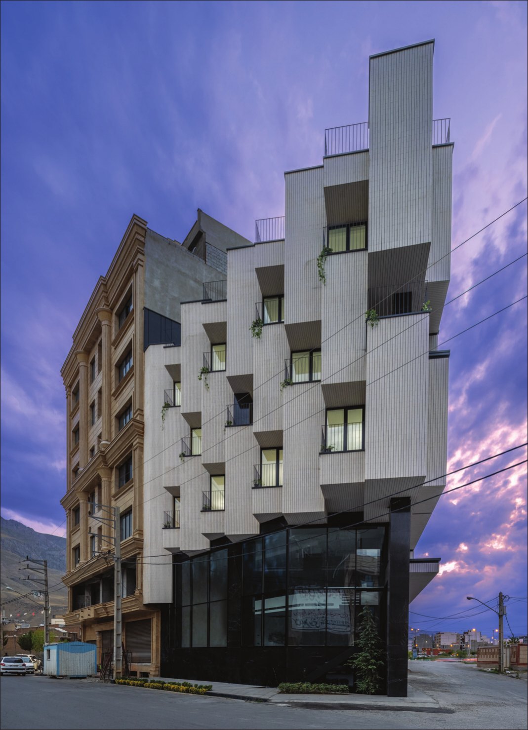
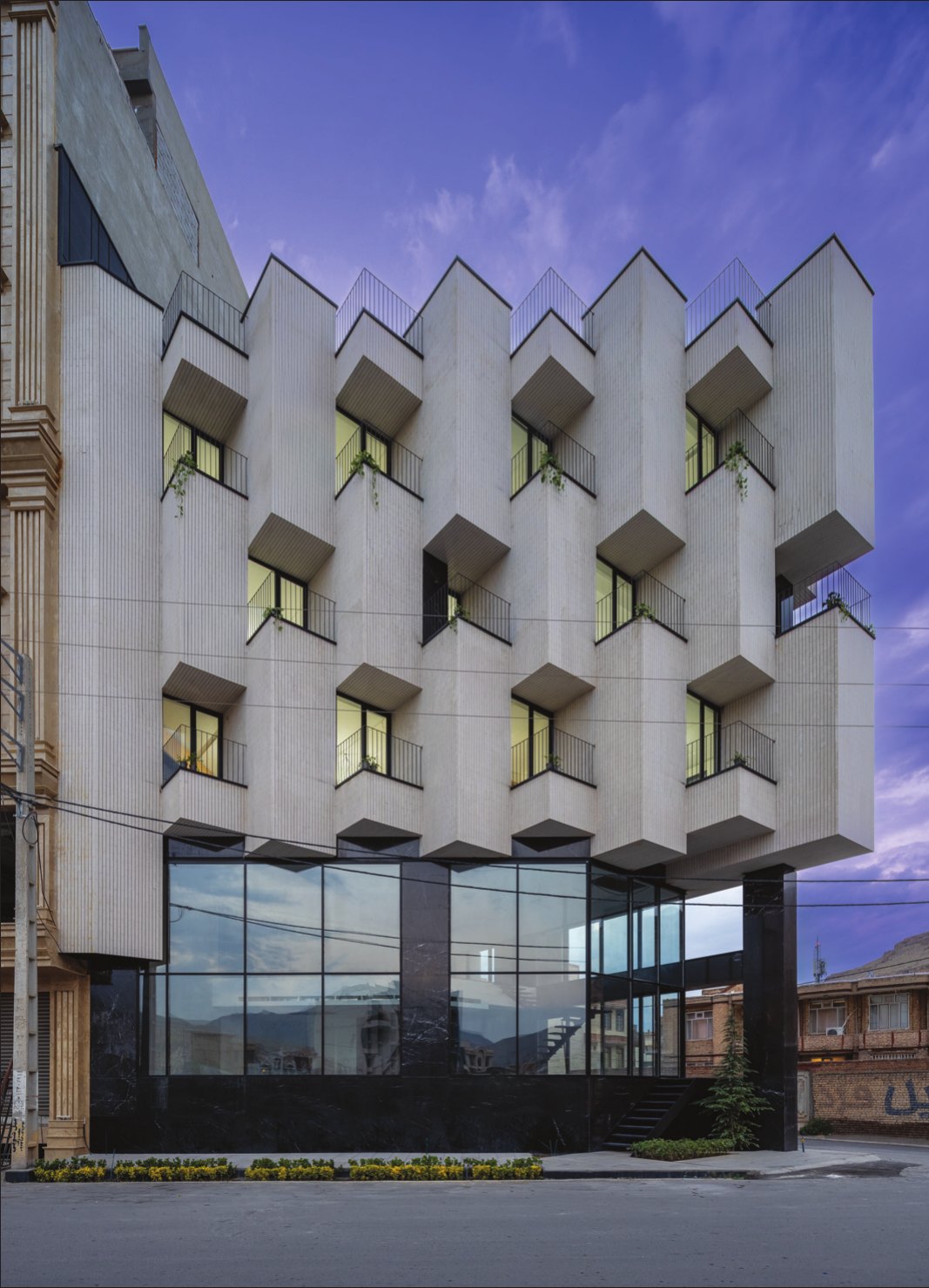
In addition to these, the chosen module and technique could provide us with the following advantages:
- Correcting the irregular geometry of the plot, so that someone inside the space does not notice this irregular geometry, or what is called the plot's skew.
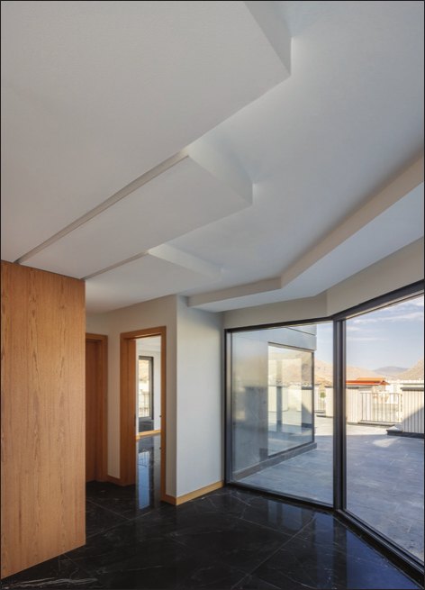
- The only connection of apartment living spaces in this region with open space is through the living room alone; the formal technique used allowed us to connect the other spaces, including the bedroom, the sitting room and the kitchen, with semi-open and open space as well.
- Creating broad views of the heights and the natural scenery
- Fluidity and greater freedom in shaping the floor plans
In choosing the facade materials of the ground and first floors (in commercial use), we sought to create maximum transparency. In other words, these floors act as a base and a backdrop that make the formal movements of the upper floors stand out more.
In the end, Torna took shape not only in response to the project's internal issues but with the ideal aim of reforming and changing the social attitude of the region's residents toward architecture, moving away from unrelated styles and toward a conceptual architecture that grows out of its context. Given the prevailing conditions our work was very difficult and challenging, but the results and the feedback of the people of the region were signs that our path was right and gave us great hope... .