Mehrazan Consulting Architects and Planners participated in the feasibility studies for the Mashhad urban rail stations, undertaking the design of two stations—Hashemieh and Daneshjoo—on Line One. This line runs along an east-west axis spanning 18.5 kilometers, connecting the eastern and western parts of the city. The eastern section, 8.5 kilometers long, runs underground, while the western section, 10 kilometers in length, lies within a beautiful linear green corridor 36 meters wide, lined with rows of mulberry trees, along the main arterial roads of Mashhad. The design concept for these two stations was shaped by the presence of Vakil Abad Boulevard as a distinctive linear garden, with its green spaces and the clarity of the sky at their locations. Certain characteristics of the Persian garden were also considered in the station design. In the 2005 Memar Award, these two projects were among the designs selected by the jury. Hashemieh and Daneshjoo Stations, Mashhad. Mehrazan Consulting Architects and Planners. Hashemieh Station.
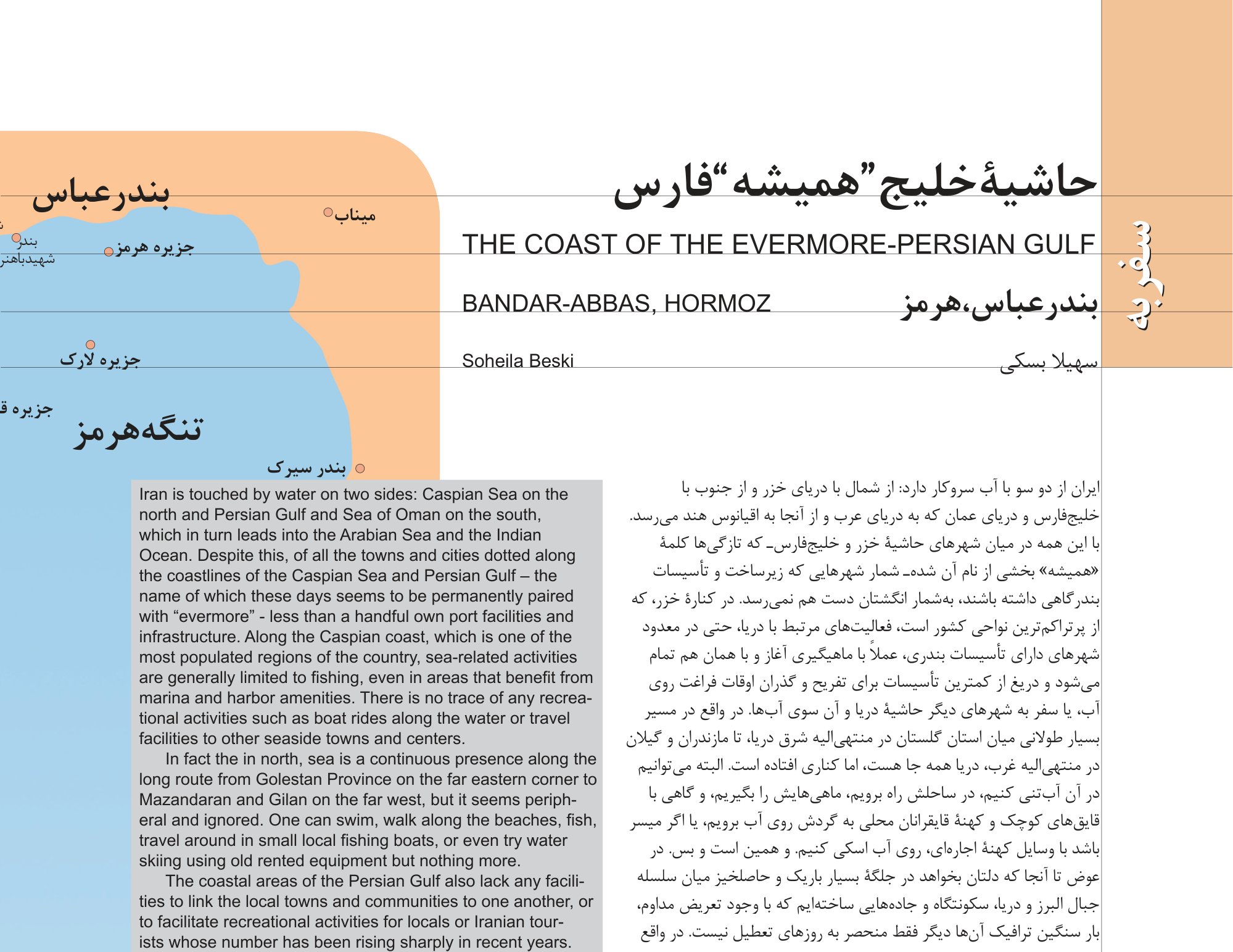
Hormozgan Province. Shaam, Dargehan, Hara Mangrove Forest, Bandar Laft, Hengam Island, Bandar Kong, Bandar Charak, Bandar Shahid Rajaei, Bandar Lengeh, Greater Tonb, Kish Island, Bandar Khamir, Bandar Abbas. It has been said that the history of Bandar Abbas, like many of Iran's cities, begins several thousand years ago, in the magnificent ancient era. And how could it be otherwise? In explaining this past, the Bandar Abbas strategic plan studies state: "The Bandar Abbas region possesses considerable historical antiquity. Historians and archaeologists believe that during the Achaemenid dynasty, this region was one of the important ports of the area. It is said that Darius, in order to control his empire and attend to conquered territories extending to the shores of the Red Sea, crossed the Persian Gulf by sailship and used its ports." Thus, Bandar Abbas is also adorned and honored by the footprints of Achaemenid emperors, although a few lines further in these same studies, it becomes clear that its historical significance is more closely tied to the period of Portuguese dominance, owing to its location facing Hormuz Island, which served as the center of operations and the hub for regulating commercial-military traffic in the region under the command of the famous Albuquerque. At that time, Bandar Abbas was a small village named "Suru," which later became known as Jarun and Gamrun. Suru remains one of the large neighborhoods of Bandar Abbas today, and this endurance—even if limited to a name—is noteworthy. In the seventeenth century, when Shah Abbas, with the help of the English, expelled the Portuguese from the Persian Gulf, Gamrun became Bandar Abbas. This name remained unshaken through the constant comings and goings of subsequent dynasties and has persisted to this day—perhaps out of the Iranians' heartfelt respect for Shah Abbas the Great. The same report notes that in subsequent years, the English and Dutch who had replaced the Portuguese built beautiful mansions and a large anchorage along the waterfront so that large cargo-carrying ships bound for Iran and the Ottoman Empire could dock there. But after the East India Company's commercial center was transferred to the port of Basra, and then Nader Shah selected Bushehr as the base for the Iranian naval fleet, Bandar Abbas's star fell so low that it was leased to the Sultan of Muscat. This stagnation continued during the Qajar era, although Bandar Abbas was still considered one of Iran's two important ports. The construction of Bandar Shahpur (Imam Khomeini Port), Bandar Mahshahr, and Khorramshahr after World War I extended Bandar Abbas's decline into the twentieth century. But thanks to the gradual rise of Mohammad Reza Shah's ambitions after World War II and the 1953 coup, followed by the establishment of the naval force and the construction of what is now called Shahid Rajaei Port—through which a significant portion of trade between Iran and other countries passes—Bandar Abbas came back to life. In the following years, its population steadily increased from 18,000 in the 1956 census to 35,000 in 1966, 90,000 in 1976, 200,000 in 1986, and 280,000 in 1996. Sharmand consulting engineers estimated it at 350,000 in 2003, and one can imagine that by 2010 it must have approached the 400,000 mark. Yesterday's Gamrun and today's Bandar Abbas has expanded to over 14 square kilometers to accommodate a population that has multiplied twentyfold over five decades. The city's expansion, situated between the sea and Mount Genu, has occurred mostly lengthwise and partly in width, and one needs no map to know that today's Bandar Abbas resembles a large, ailing shark washed up on the shore of the "forever Persian" Gulf. But aside from its shark-like shape, it is virtually identical in every other respect to all the other cities of our—as Mohammad Ghaed put it—ancient Aryan-Islamic land that are not situated by the sea. Whenever I arrive at one of these identically shaped cities, the thought crosses my mind: if someday in the future someone wants to explain the structure and fabric of these cities, instead of shaarestan and citadel, what elements will they name? The Moshta seaside and fishing nets, photo from the book From the Skies of Iran, Jasem Ghazbanpour.
Without doubt, one of them would be a central street in the older part of the city, as though it were registered in the deed of every one of them that it must take the form of a linear, high-traffic boulevard with rows of shops along its edges and roundabouts at equal intervals that partly serve to collect and distribute traffic, and nearly all of them in all the cities have had and continue to have the same name. The second element must be large commercial buildings with gaudy facades, often with colored glass and recently with aluminum panels. In Bandar Abbas, a dozen of them are lined up along the narrow central boulevard: Zeytoon, Sarv, Setareh-ye Shab, Morjan, Shahab, D-to-D... and since apparently these and the commercial buildings in the surrounding area and on the coastal road parallel to the central boulevard were not enough, several more large centers are under construction along the same stretch. One of them, which appears to be the largest, bears the amusing name Queen of the Sky. During the February holiday period, when a vast crowd had come from the farthest corners of Iran—from Kerman, Isfahan, Khorasan, Azerbaijan—and surrounding towns to Bandar Abbas to kill two birds with one stone, meaning pre-Nowruz shopping for themselves or their stores and a bit of recreation, the condition of the street was not unlike the scenes of the Last Judgment depicted in medieval paintings—with the difference that people here were clothed. It seems to me that to the list of permanent elements of our contemporary cities, one could add the eternal scaffolding of buildings under construction on every street and alley, as well as the narrow, uneven, patched-up sidewalks separated from the street by gutters filled with polluted puddles and flowerless, grassless planters. The gutters and planters have been repurposed as garbage chutes by shopkeepers and passersby in nearly every city. Meanwhile, one should not forget the cloth banners that have replaced many neon shop signs, or the bold-lettered slogans and admonitions officially painted on every available wall. In judiciary buildings in some cities, the admonitions have been framed and mounted on walls and railings. Recently, wall murals of flowers, nightingales, trees, and streams, painted in the same style as pickup-truck art, have been added to this urban ornamentation, though they have not yet reached Bandar Abbas. Of course, every city has its differences. For instance, in Bandar Abbas there is no trace of the ruins of mud-brick buildings and cracked old urban fabric that form part of the cityscape in many of Iran's ancient cities. In fact, the past has been almost completely leveled—no sign of the vine, nor of the vine's trace. Only a few shops have placed the name "Gamrun" on their establishments, and a few historical buildings remain, invisible like drops of water in the sea. One of them is the Kolah-Farangi building, reportedly built during the Dutch era and later used as a customs house. Today this building houses the city's theological seminary. A Hindu temple, recently restored, is a relic of the Indians who once traded at and even settled in the port. Remnants of a bathhouse, a mosque, and a ranch house remain, abandoned to their fate. Of the old bazaar, a few arcades and fragments of the original roof survive; the rest has been covered with corrugated sheets of every kind, presumably according to the taste of seasonal repairmen. The only visible old elements are the egg-shaped water cisterns abandoned in the back alleys. Several more stand behind the Ethnography Museum, and it seems they have survived if only for the museum's sake. The Ethnography Museum has a newly built, handsome brick building, and right beside it stands the Ministry of Culture and Islamic Guidance building—under whose jurisdiction the museum falls—built of stone in a completely different style and appearance. Inside the museum, the sculptures by Negar Naderi are well worth seeing. Images of the bazaar and commercial centers of Bandar Abbas. The coastal road, Ayatollah Taleghani Boulevard, photo from the book From the Skies of Iran.
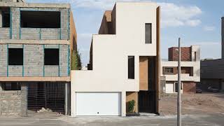
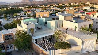
But from the more recent past, more things remain. In the old neighborhoods around the central boulevard, traces of the era of relative calm that prevailed in the city before the rapid population increase of recent decades survive in white-painted buildings with simple and pleasing modern architecture, whose elegance—particularly in the facade ornamentation with shapely porticoes, rain guards, recesses, and projections—is at times astonishing. The architecture of the NEDAJA (Navy) residential compound is even more surprising: square houses with one angled side and simple concrete facades. Rooftop wind catchers and white concrete lattice screens also draw from vernacular architecture. Because it is a military compound, photography was not permitted, but we were told that an Israeli company had built the compound in the pre-revolution years. Geographically, Bandar Abbas's downtown lies in the western section of the central boulevard, and at the far west it reaches the Bahonar and Rajaei ports and the gated residential compounds of the navy and other organizations—though only after passing through a long stretch punctuated here and there with scarred, pockmarked wasteland. Wasteland can itself be considered one of the permanent elements of today's cities—remaining barren for prolonged periods, sometimes decades, even in densely packed central areas. The airport and the cleaner, more orderly, more upscale newly developed areas in the eastern part of the city present an astonishing contrast to the western section. Nearly all newly built government buildings are located in this area, and among them one can even find examples of late modern architecture, such as the Shahid Avini Auditorium or the Hormozgan Music Association. A large seaside park with the same gazebos topped with conical red ceramic caps and playground equipment in bold reds, purples, greens, and blues is here as well. Other very large buildings, overlooking the sea or farther from it, are under construction in this area. In fact, this section is literally on scaffolding. Nevertheless, after the intense disgust provoked by the chaotic, disorderly, and polluted central and western parts of the city, one involuntarily becomes grateful for even this degree of cleanliness and attention to some basic standards of urban life, and grateful for the work of ranked consulting engineering firms that appear to have built the simple brick buildings and the government cultural, artistic, and sports facilities that possess some order. But the rest of the city, too—the areas in the northern zone at the foot of the Genu Mountains, built or being built as various compounds for cooperatives and Mehr housing for lower-income groups—is exactly like the developing sections of other cities: disjointed, fragmented, with disorderly streets, resembling large construction sites, and in Bandar Abbas, besieged by roads and highways full at all hours with trucks and trailers carrying the enormous volume of imports into the country. And where is the sea? The sea is right behind the southern edge of the central boulevard, just a five- to six-minute walk away. But when you cannot see it, you do not feel its presence. In Bandar Abbas, even the sea's humidity is not like that of the Caspian shores. Perhaps the hot sun dries up the moisture quickly, preventing vegetation from sprouting through every crack and crevice as it does along the Caspian coast. The city is on one side and the sea on the other. Even the boat engine repair shops and the placards announcing ship ticket sales at travel agencies do little to reinforce the sea's presence in the city. The coastal road, running parallel to the central boulevard in the western section, has the same disheveled appearance as other streets in this part of town. The houses in the side alleys resemble those of the urban fringe in large cities and Tehran, and some of them have been converted into warehouses for contraband goods brought into the city by boats. Some of the small entrances to Bandar Abbas's bazaar also open onto this street. A large Sunni mosque, not unlike the mosques of Dubai, stands in this area—clearly a great deal of money was spent building it. But despite its grand and imposing presence, the row of commercial units, the city's fish market, and the alternating tall commercial buildings facing the sea have created one of the ugliest coastal scenes I have ever witnessed. The Haqqani pier, which serves passengers to Qeshm and Hormuz, is in this same area. It has no proper building and in fact consists of several shipping containers. This pier is currently closed for repairs. In its place, a makeshift temporary pier has been cobbled together in a dreadful condition. The photographs of this "pier" are so telling that no elaboration is needed, but the important point is that right next to this official pier, a section of the coast is openly devoted to the smuggling of contraband goods into the city by small boats. "Right next to." Traditional clothing of southern women. The unauthorized but openly operating dock next to the official Haqqani pier and the Homa Hotel.