


I know of two cities in Iran where entering them feels like stepping into a private home or estate, where a natural feature plays the role of a wall, distinguishing the spaces inside and outside the city with a decisive boundary. The first is Kalat-e Naderi in northern Khorasan, a city enclosed within a roughly elliptical ring of mountains, whose present entrance is a tunnel — upon passing through it, one suddenly transitions from a barren, rugged mountainscape into an urban setting with elements and features resembling most other cities. The second city with such an atmosphere is the port of Siraf, on the southern edge of the Iranian plateau, on the shore of the Persian Gulf.
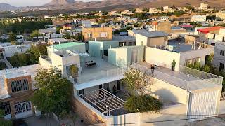
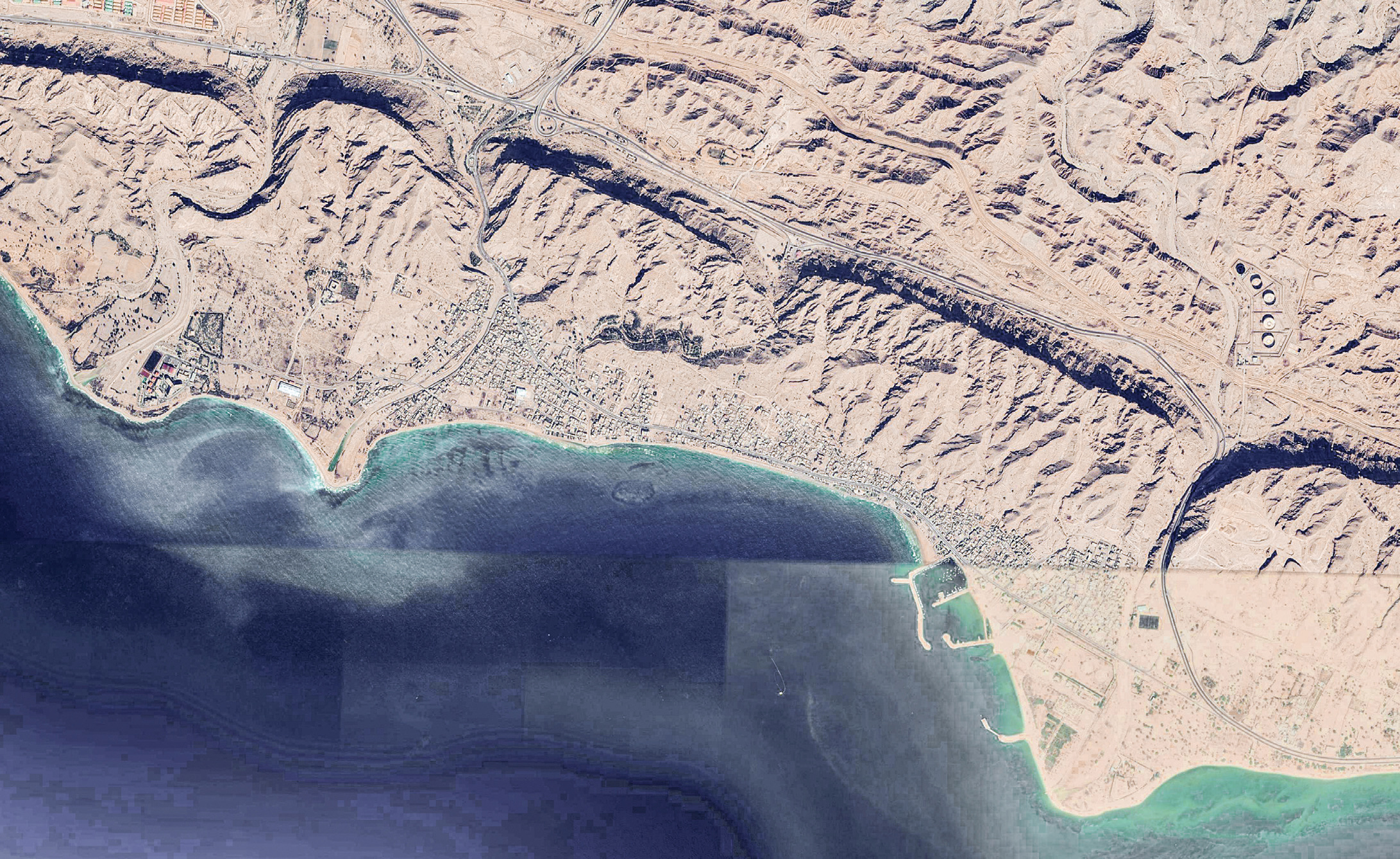
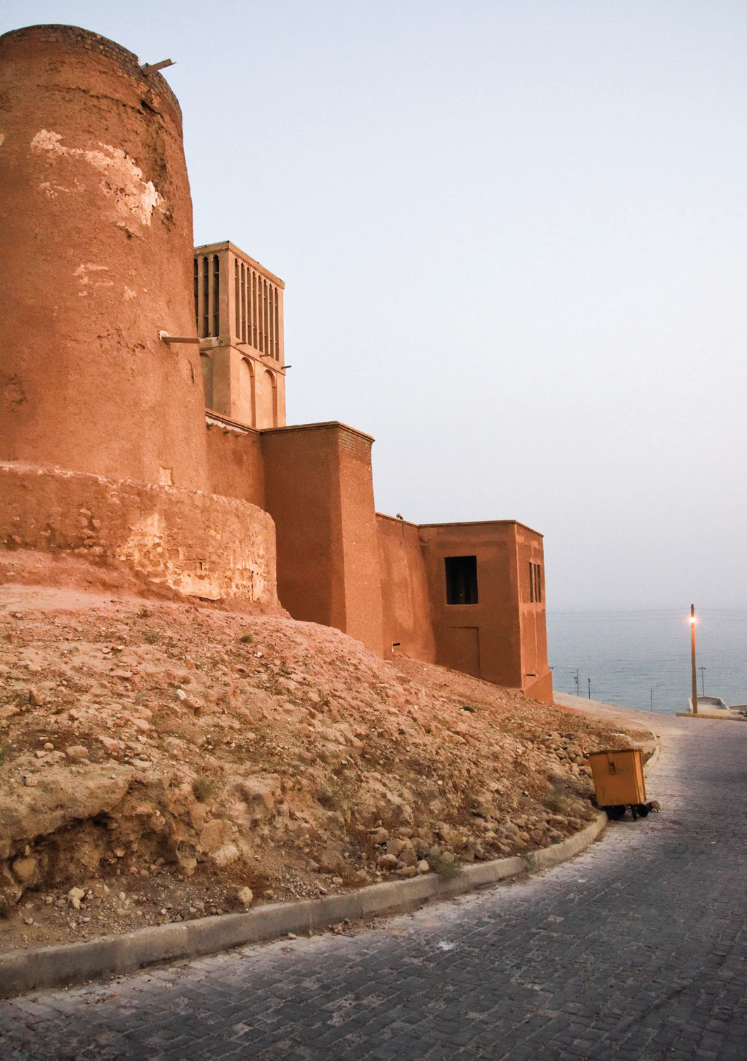
Siraf is built on the southern slope of the last range of the Zagros Mountains, and unlike most ports that have spread themselves across flat land extending from the sea's surface, it is built on a narrow, sloping strip — the foothill of that very last range — which continues with more or less the same gradient into the water. Siraf does not sit at sea level but overlooks the sea, resembling certain villages on the volcanic islands of the Mediterranean (such as Stromboli), with a particular topography that has led to a linear expansion — a city that essentially has one main street running parallel to the mountain ridge and the coastline.
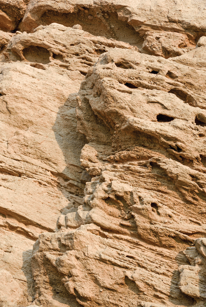
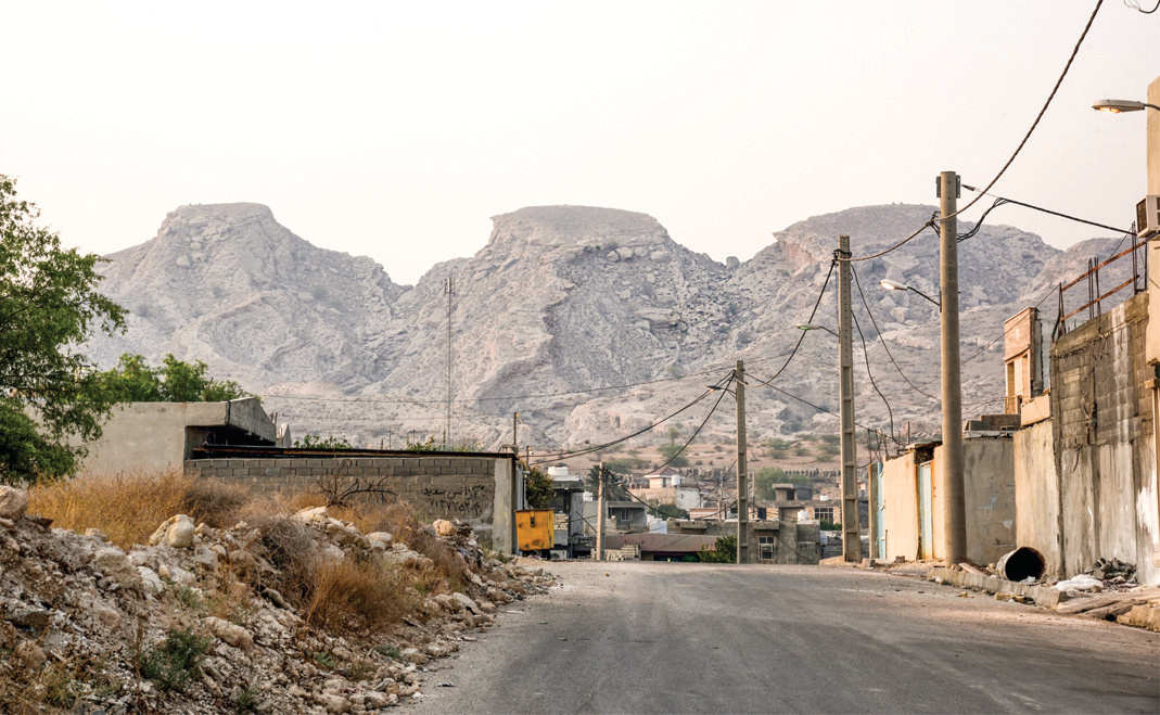
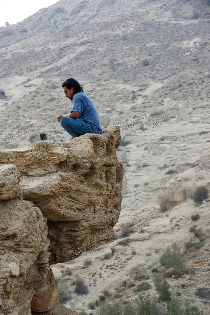
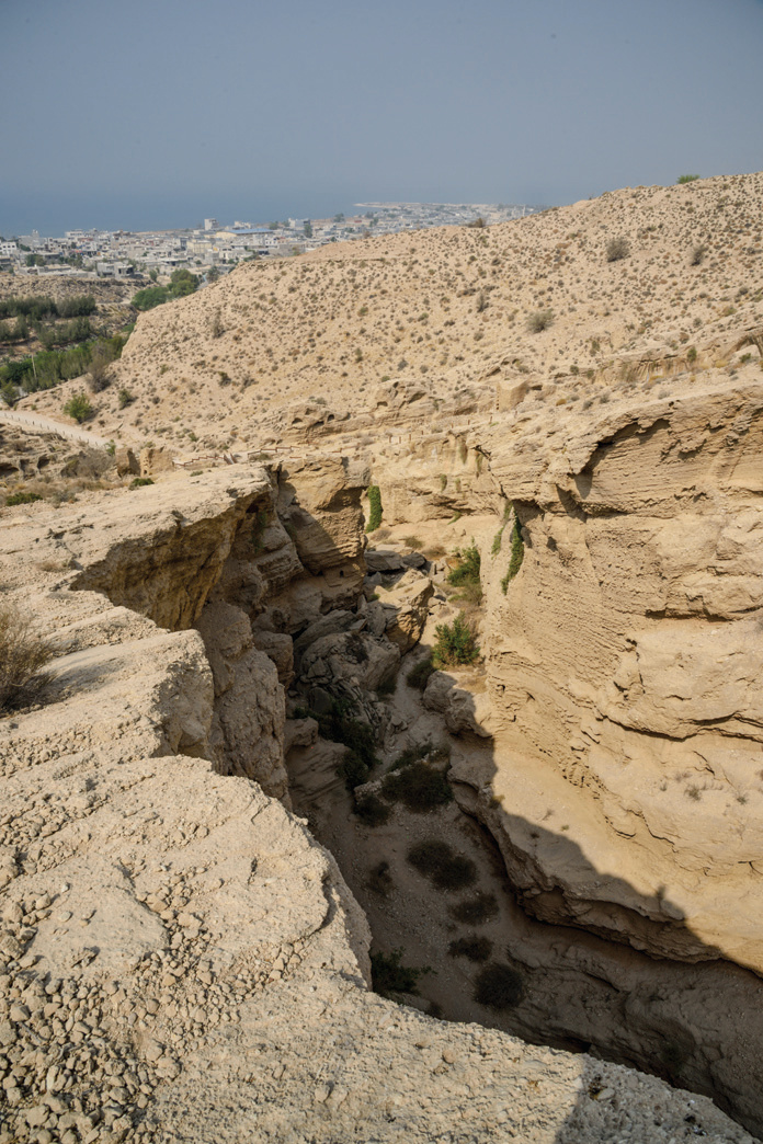
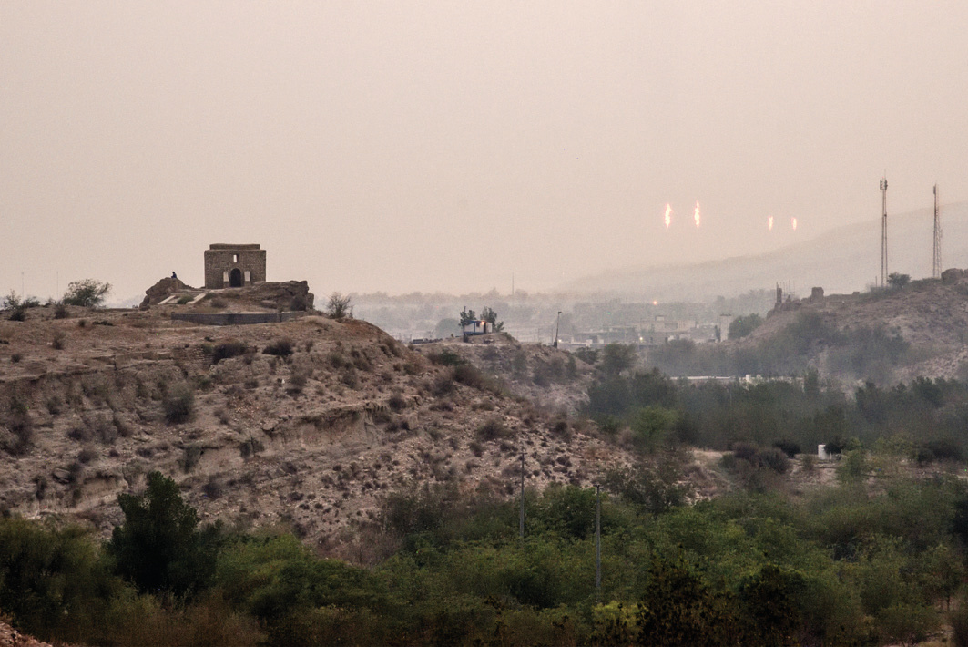
Within the Siraf district, the road between Bushehr and Bandar Abbas passes behind (north of) the last coastal range — the very range on whose southern slope Siraf sits. Alongside this road, from before Kangan (30 kilometers west of Siraf) to the vicinity of Chah Mobarak east of Asaluyeh, over a stretch of roughly one hundred kilometers, gas and petrochemical installations have been erected piecemeal. These installations have not only severely polluted the region's air but, with their numerous tall vertical elements and the hundreds of high pylons carrying their electricity, have greatly "cluttered" the natural landscape. The access road to Siraf branches off from this highway and, after passing through a gorge that cuts through the last mountain range, reaches Siraf. Passing through the gorge, entering a Siraf that has no distant prospect, the sudden sight of the blue expanse of the sea, and an air that is strangely cleaner than the air along the highway — it is like entering a serene, limpid garden at the end of an alley off a noisy, bustling main street, evoking the same sense of tranquility and seclusion. The gorge itself, whose space is not unlike the ornate entrance spaces of magnificent historical buildings — except that its ornamentation is not of muqarnas, tile, and stuccowork, but of abstract volumes and patterns sculpted by thousands of years of natural forces.
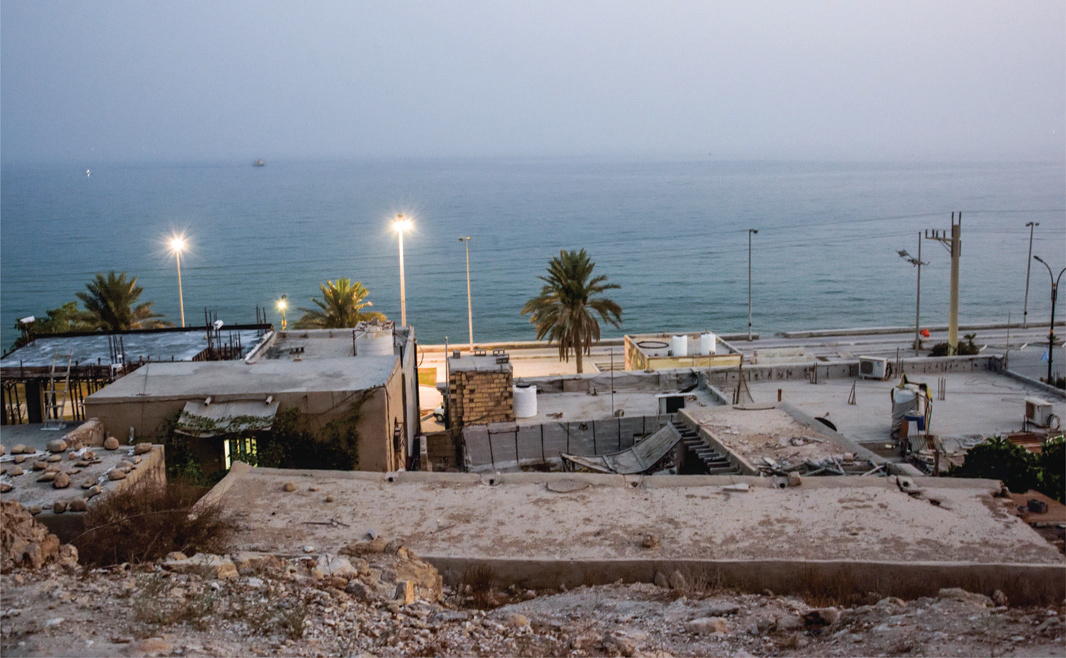
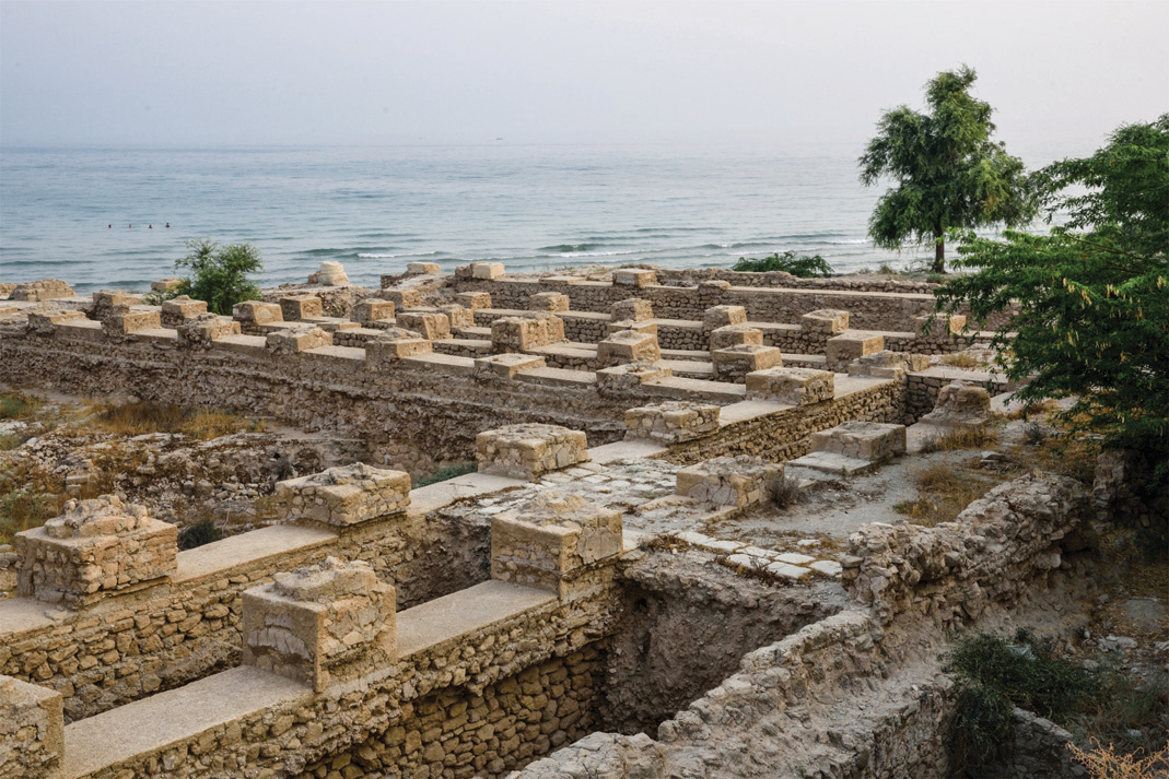
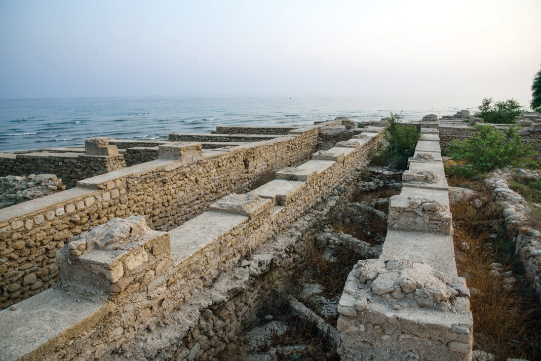
Beyond its linear spatial structure and its command over the expanse of the sea, Siraf possesses another characteristic that is rare among the coastal towns and villages of Bushehr province: its attachment to the water's edge. Aside from two or three large cities, most of Bushehr's coastal towns and villages do not sit by the water but are set back several kilometers from the shore. They have harbors and piers where their boats and dhows can dock, but their residential fabric lies further inland. This retreat probably has a water-related reason: all population centers in Bushehr province depend on water that flows down from the Zagros valleys. The coastal lands are generally saline to a depth of several kilometers, rendering both surface and underground water saline. But Siraf, perched on a height and backed by the freshwater of the Lir Valley to its north, sits comfortably on the seashore. Although this water is too scarce and Siraf's rocky ground too hard for horticulture or animal husbandry, this modest supply has for centuries not only quenched the thirst of the Sirafis but also provided water for the seafaring vessels of the port.¹
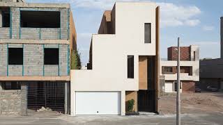
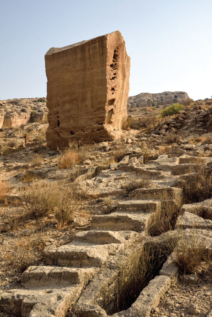
Siraf was, at least from the reign of Ardashir Babakan until the late fourth century AH and the earthquake that destroyed it, the most important Iranian port on the Persian Gulf, reportedly trading with ports as far as China, India, and Zanzibar. The reason why this particular, strange place was chosen was probably the convergence of three factors: adequate coastal depth, access to freshwater, and a commanding view of the sea with the ability to control and defend the port. Nearly everywhere in Siraf has a good view of the sea — something that elsewhere is a source of contention, with hotels even charging guests extra for it, but in Siraf is cheap, abundant, and accessible to all. The narrow width of the city's land and its seaward slope give most of the city a view over the sea, and it is hard not to have a sea view. Among all buildings old and new, the Nassouri Castle commands the finest view — it was once the governor's seat of Siraf.
But the castle's vantage point cannot be analyzed through a modern lens, as though they wished to sit up there to gaze at the sea and take pleasure in it. During the few days I spent in Siraf, I had the fortune to stay in a house surviving from one of Siraf's old families — a house that, despite all the renovations it had undergone, seemed to have largely preserved its original spatial structure. The doors of its rooms opened toward the northwest, facing a courtyard whose trees tempered the sharp afternoon sun. The rooms had no windows at all — only a small transom above the entrance door to prevent total darkness within. In other words, despite its land being at one of the closest distances to the sea and commanding a full view of it with its elevation, the matter of vista and panorama had absolutely no place in the architecture of this house.²
A roughly similar preference can still be seen in villages and small towns that are still quiet and tranquil. But in Siraf the matter goes beyond habit and repetition: the concern for view and landscape, or other architectural considerations that have become important for today's urbanites, are overshadowed in a place like Siraf by the utterly dominant factor of heat.³ Siraf's heat, especially before the advent of coolers and refrigerators, could exceed the limits of human endurance, and it is self-evident that for someone on the verge of collapsing from heat, one cannot speak of views and such things — they are willing to forgo vista, landscape, natural light, and many other things just to rest a moment from the torment of heat.&sup4;
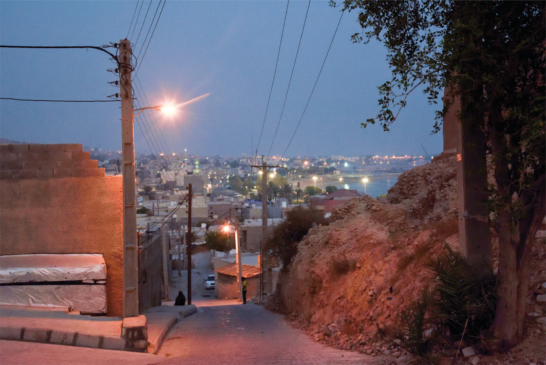
Yet the effect of Siraf's historical depth and the exchanges it has had with the outside world since distant ages can still be felt: in the surviving monuments and buildings of Siraf, traces of several historical periods with several different mentalities and cultures can be seen, layered upon each other like the sedimentary structure of the mountain on which Siraf sits. Likewise, in the manner and behavior of the Sirafis there is a genuineness that cannot be unrelated to this historical rootedness — a history that even if someone knows nothing of, they sense in the atmosphere of their city, as though it has settled in the depths of their being.
The main stage of Siraf is this narrow, sloping strip along the sea, but Siraf also has a backstage on which the survival and "demise" of the main stage depends: in the mountain against which Siraf leans there is a valley called Lir, whose rock-cut graves, ossuaries, and wells are well-known and famous. The common account of the stone graves of the Lir Valley is that they were built to retain water and allow it to percolate into the underground aquifer, and were later repurposed as graves due to events such as earthquakes or epidemics. Those who have reached this conclusion in their research have evidence for it, but for me it remains unclear: if the purpose was water collection, why were the pits all built as uniform rectangles? Why were some built on the ridge line, where water would not linger even for a moment? Why is the length of the rectangles perpendicular to the contour lines rather than along them? Yet every structure related to water takes its form from hydraulic logic and the physical behavior of fluids.
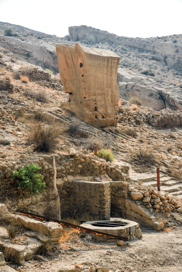
In any case, whatever the original purpose of these grave-pits may have been, two things about the Lir Valley are certain: the wells dug in this valley supplied the freshwater of Siraf and its ships, and near these very wells there are dakhmehs and ossuaries that served no purpose other than burying the dead. Moreover, the open graves with varying geographical orientations attest that they were used by people of different religions and faiths.
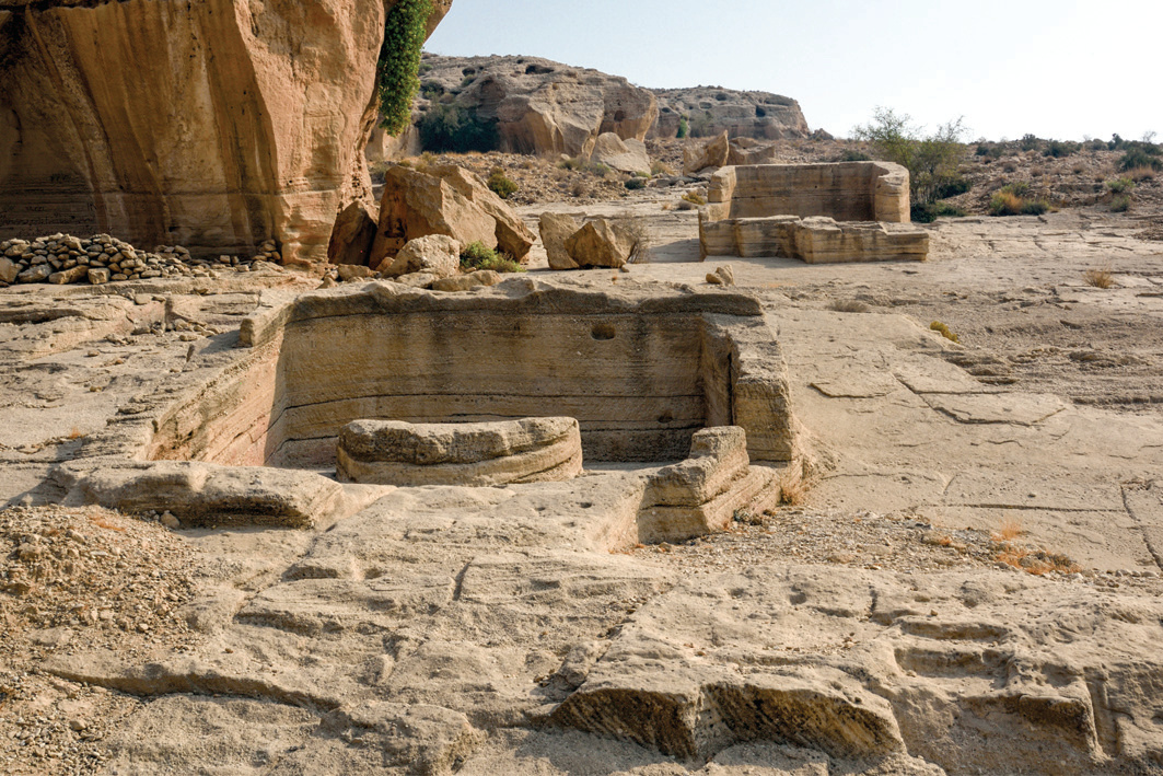
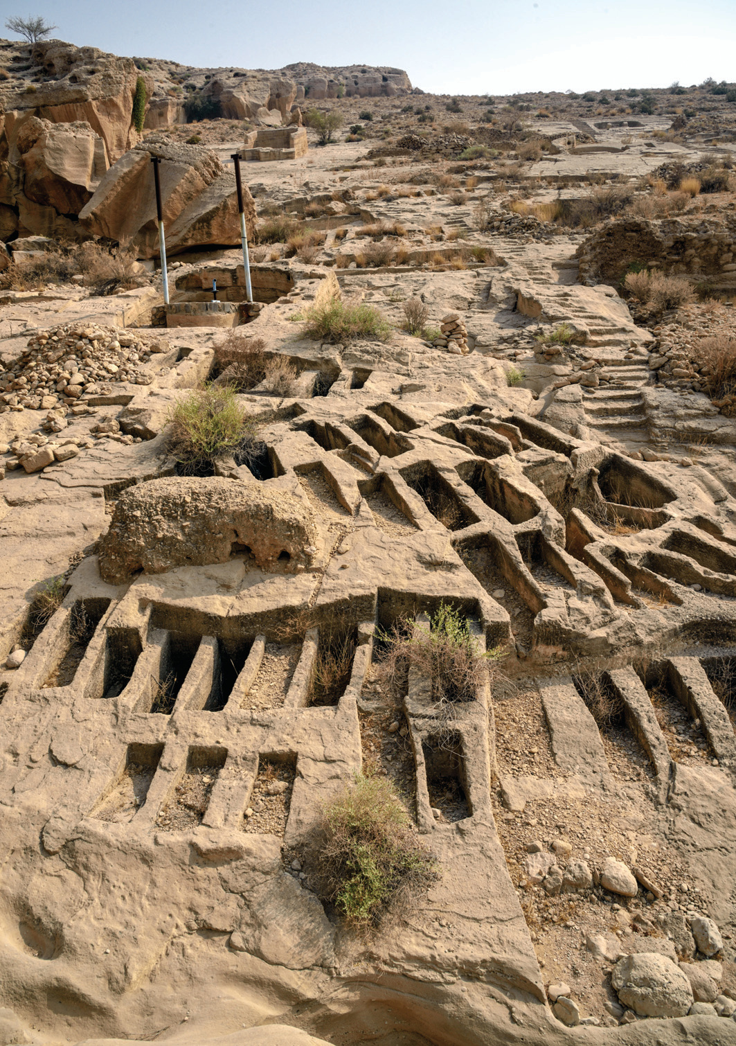
Water is the essence of life and prosperity, and few can feel this as keenly as the Sirafis. On the other hand, cemeteries and corpses are always considered impure and inauspicious, to the point that even Tehran's neighborhood cemeteries are shut down on the pretext of public health. But in the Lir Valley, death and life have been neighbors for centuries, and in its not very vast expanse, wells and graves and ossuaries sit close together — a coexistence of a thousand-odd years that has apparently never threatened anyone's health or hygiene.
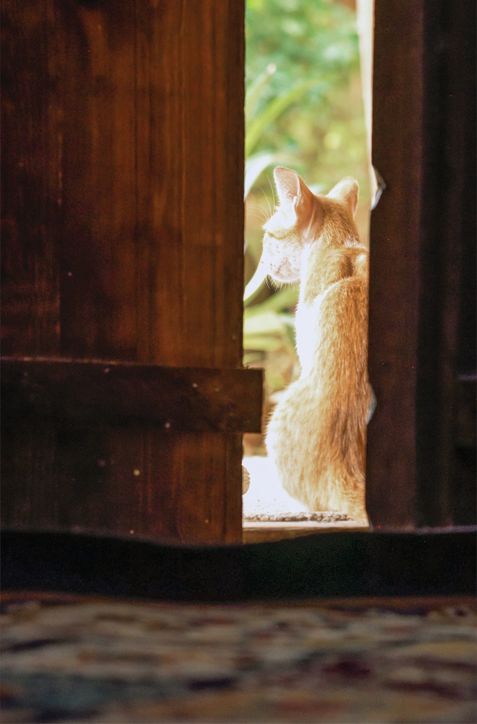
Siraf today does not possess the prosperity and importance of the Sasanian era or the early Islamic centuries, but it is a thriving, living city whose singular beauty enchants every newcomer, and from the great number of its restaurants and cafés one can guess that it has a people who are well-off enough. Southern cities, especially on summer afternoons, have a listless appearance, as though depressed by the heat, but beneath this depressed skin runs a happy, colorful life that reveals itself from sunset until the late hours of the night. In the very house I mentioned, two cats resided — they had a lean, scrawny appearance, but after an hour or two of becoming friendly and tame, it turned out that they were not only extremely nimble and sprightly but had full, strong bodies — their short fur just made them look that way. Life in the cities of the south is not unlike the condition of those two cats, especially in Siraf, which — like its delicious qalieh mahi and falafel, and like the colorful garments of its women — is full of color and flavor.
1. Some internet sources cite a population of 300,000 for Siraf in its heyday, which is undoubtedly wrong. Neither does Siraf's land have room for such a population, nor could its meager water supply sustain the drinking needs of so many.
2. In the very beautiful village of Nayband in southern Khorasan, a not insignificant number of locals own and drive trucks — mostly those single-axle ten-ton Benzes, called "dog-gear" by the drivers. If one of the Naybandis drove one of those into the village fabric and graced everyone with its noise and smoke, it wouldn't be a bad thing, since it would add variety to the monotonous silence. Nayband is called the "Masuleh of the desert," but calling it the "garage of the desert" would not be entirely inappropriate either.
3. Forough Farrokhzad, in praise of someone whose night was colored by their dream, says: "O bright sunrise without sunset / Sun of the lands of the south." Forough probably experienced the southern sun in winter, for if the midday July sun of the south had touched her skin, she would have put this verse in a satire.
4. A wise sage was asked: Which is more painful — the pain of love or the pain of hunger? He replied: Go without a toilet for half a day and you'll forget both... The heat of a place like Siraf is of such intensity that it can make one forget every other concern.